

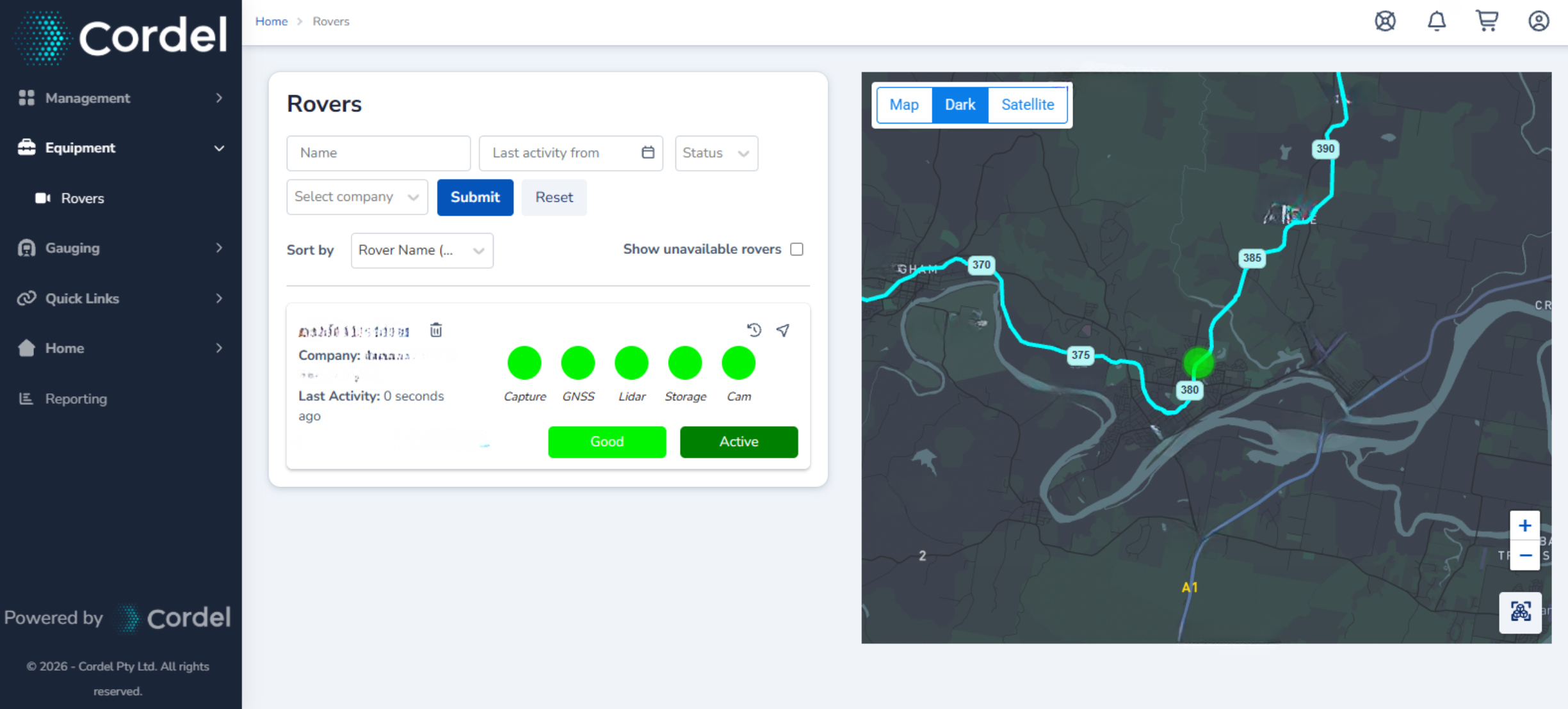
The Rovers page provides users with the ability to view the location and status of their Cordel capture equipment.
Search
Users can search for a specific Rover using the following filters:
-
Rover name: The name of the Rover.
-
Status: The Rovers' recording status.
-
Last Activity: The time the Rover was last seen.
Rovers
Each Rover registered to your company will be displayed on this page. Each Rover has an information card and a colour coded map marker.
This provides a quick visual indication of the location and overall state of each device, as well as the health of each individual sensor.
Rover History
To view historical capture information, click the history icon

(History) will be displayed next to the rover name and filter options will be displayed.
Rover history can be filtered by date range, telemetry status or capture status. The Total Distance respects the filters being used, as does the Rover map.
The polylines on the Rover history map are stacked by severity - so error and warning states remain visible rather than being hidden beneath lower-severity data.
Note: Total distance is based on raw GPS data and may not always be fully reflective of actual capture distance.
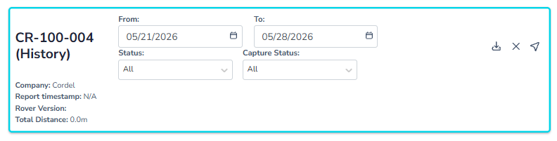
Rover history can be downloaded as a .GPKG file using the download icon.
Overall Rover Status Legend
When viewing a Rover marker on the map, the marker is coloured according to the overall status of the Rover:
🟩 Good. The device is fully operational.
🟦 Ready. The device is ready to capture.
🟨 Yellow: Warning. There may be issues with the device, or the device isn't fully functioning.
🟥 Error. There is something wrong with the device.
⬛ Unavailable. The device is not connected to power or is out of 4G service.
Sensor Status Legend
Sensors shown on the Rover Information card include the following statuses:
CAP - Capture Sensor
🟩 Capturing
🟦 Ready To Capture
GNSS Sensor
🟩 Good Fix - Fix type is one of the following:
-
RTK FIX
-
RTK FLOAT
-
Sbas
-
Dgps
🟨 Warning - No Fix
🟥 Error - Represents one of the following:
-
No Decoder
-
No Stream
-
Not Decoding
-
No Data
-
No Signal
LiD - LiDAR Sensor
🟩 Capturing
🟦 Ready To Capture
🟨 Warning - Represents one of the following:
-
Lidar Depowered
-
Powered Down
-
No Time Sync
-
Invalid Time Sync
-
No Time Exc
-
Dropped Packets
🟥 Error - Represents one of the following:
-
No data yet… (Treat as an error if message persists for more than 30 seconds.)
-
No Data
STOR Storage
Displays the available storage space on the selected device.
🟩 Ample available storage - more than 10GB
🟨 Enough available storage - between 5GB and 10
🟥 Not enough storage is available - less then 5GB
CAM - Camera Sensor
🟩 Capturing
🟦 Ready To Capture
🟥 Error - Represents one of the following:
-
No Camera
-
Unknown Mode
-
Not Listening
If you need any assistance with your Cordel capture hardware, please contact the service desk.