

This release focuses on changes to notifications within the Cordel Connect platform and introduces imperial measurement functionality in Slice Viewer. The team has made changes to the back end to improve configurability as well as bug fixes, as we continue to improve the overall customer experience.
Core Product Updates
⭐ Feature Highlight: Increased configurability of Notifications ⭐
cordel connect
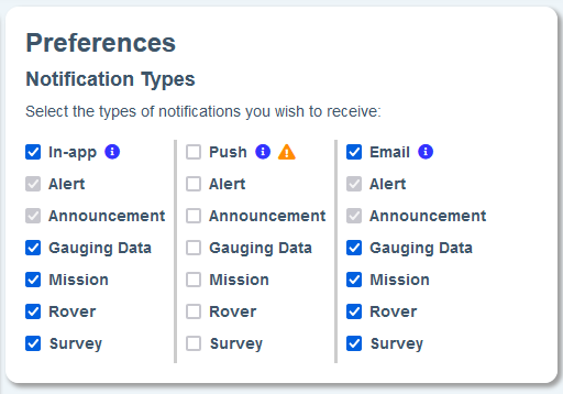
Users can now opt-in or out of notification categories, and these can be controlled separately for each communication method.
Changes were also made to the severity of notifications, meaning users will now be notified when gauging data entities are commented on in the audit trail.
Note: Notification options vary, depending on the features enabled in your environment and your user permissions.
clearance/gauging
-
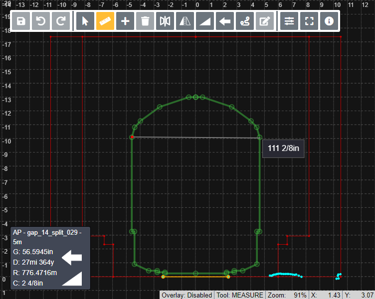
Imperial (feet & inches) is now available in Slice Viewer. When using the “Imperial (Feet & Inches)” measurement units for engineering, the Slice Viewer will now display the grid and measurements using feet instead of metres.
-
There are no changes for the Slice Viewer when using the “metric” measurement units for engineering.
-
Support email link and Support Desk icon link are now available on the “Forgot Password” page
-
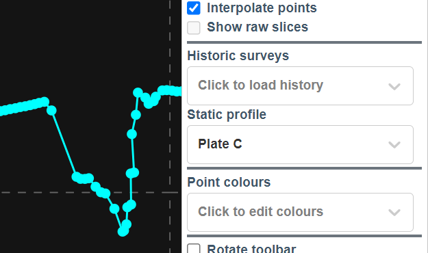
Slice Viewer: Point interpolation has been changed to be enabled by default
We have made changes to the way slice point interpolation is rendered to improve consistency with downstream systems. After consultation with clients, it was determined that it is preferable to have point interpolation turned on by default.
-
When a survey is archived, the system will now republish the latest superseded data for any associated structures when available if there are no published slices present for the structure
Previously, when a user archived a published survey with slices for a structure that has previous superseded slices, the previous / most recent superseded slices remain in a 'superseded' state. Now, the system will update the previous / most recent superseded slices to 'published.'
🐞 Fixes 🐞
cordel connect
-
Additional spaces surrounding input on text fields will no longer cause searches to be unable to find the desired results
-
Explorer map: Rover position will no longer jump when position data is temporarily unavailable
-
Explorer map: Resolved the issue where mission information would not always display when clicking a mission trail line, and may not have been clickable when overlapping with the Linear Referencing System (LRS) lines
-
Cloud Optimised Point Cloud (COPC) LiDAR: Resolved issues blocking COPC files from being loaded directly from cloud storage
-
Help widget: Generate screenshot button has been reinstated
-
Help widget: Resolved issue causing some support tickets to not be created, when using plus addresses
clearance/gauging
-
SC0 slices with excess empty lines after the content can now be uploaded