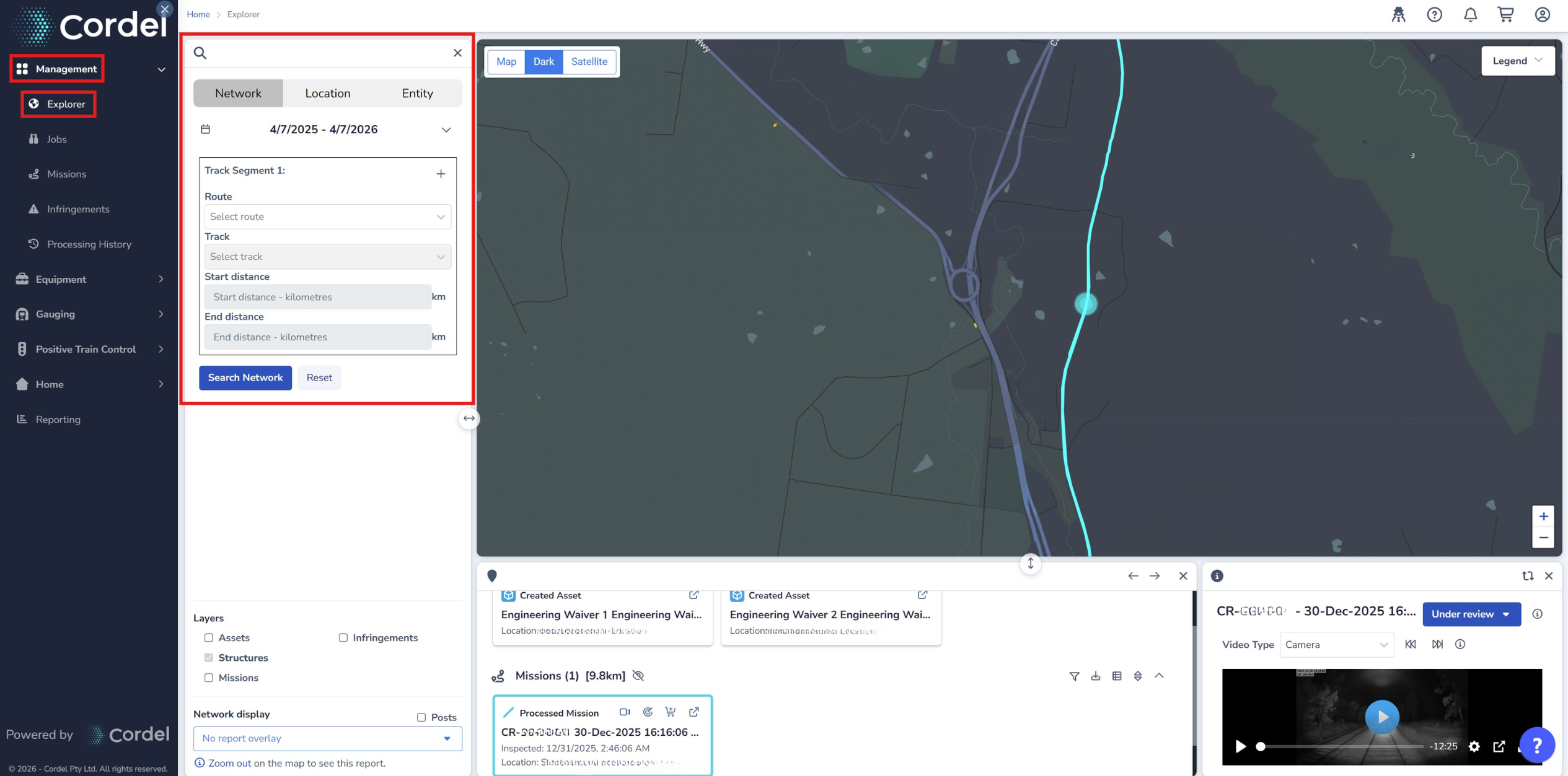
The Explorer map features several search options, allowing users to search for data found in a specific location, or captured within a specific timeframe.
To search for data in Explorer, navigate to Management> Explorer> Search
Where users expect a search to produce a lot of results, Cordel recommends using a smaller Search Radius size or filtering their search by a narrow date range to avoid impacting performance.
How to filter a search by date
Regardless of the search type, users can filter a search by date using the date range filter below the search option tabs.

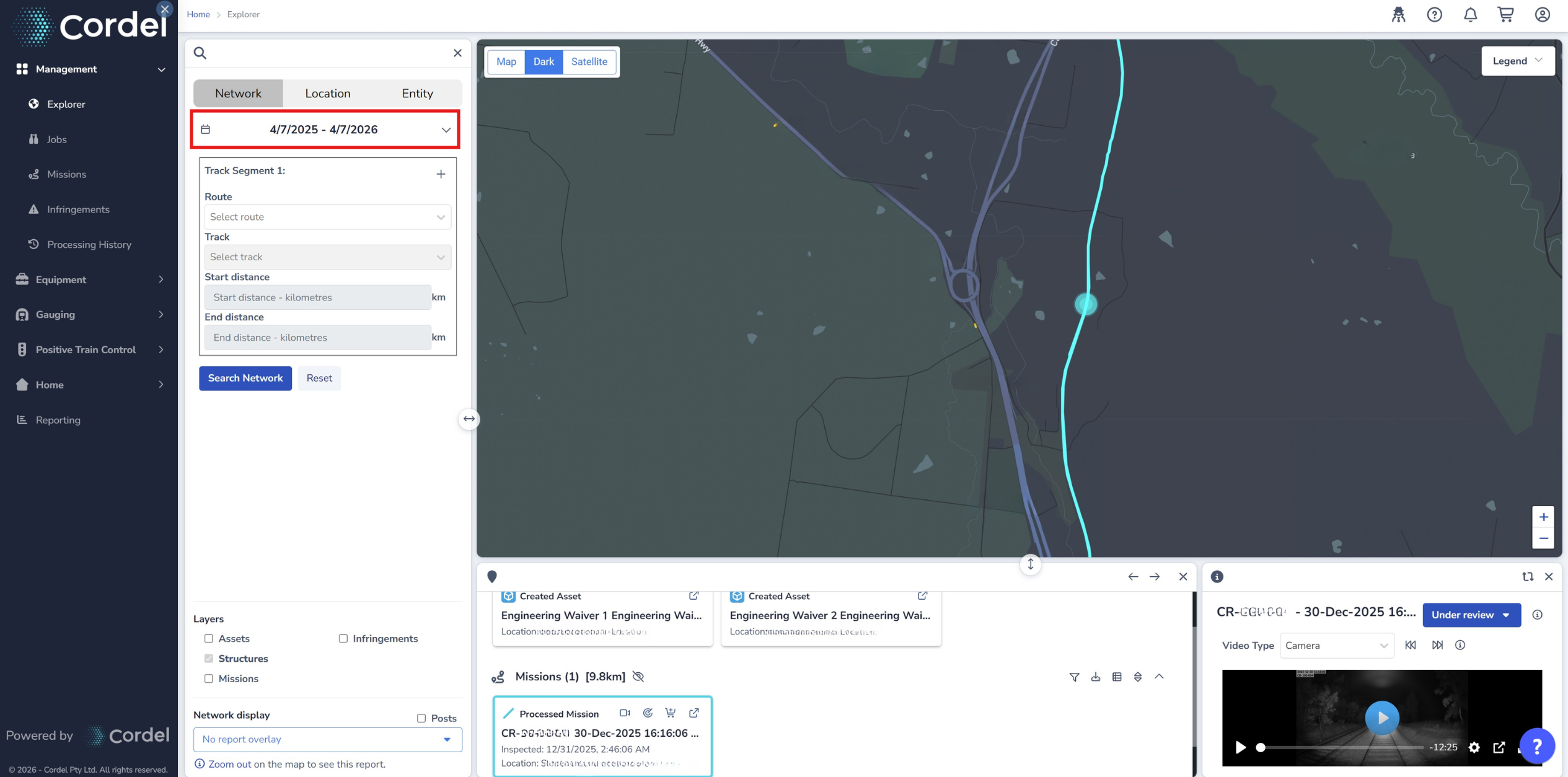
Structures - date filters are not applied to Structure search results (structure search results are only filtered by location).
Network Search
How to conduct a Network Search
-
Click the 'Network' tab in the search area
-
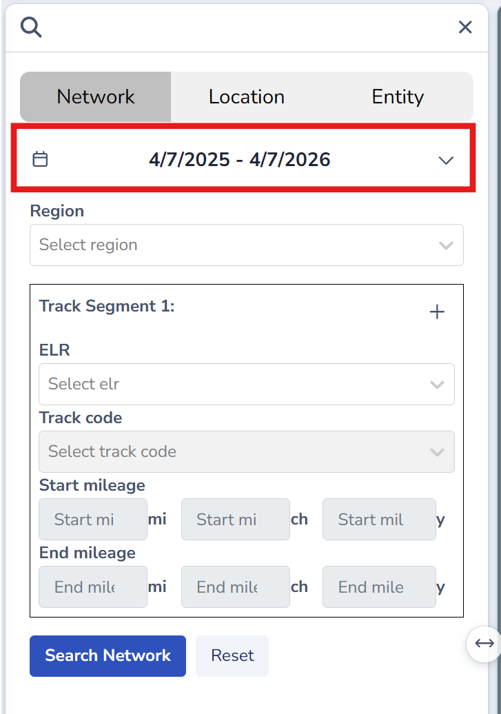
Edit the date filters to include/exclude the appropriate data
-
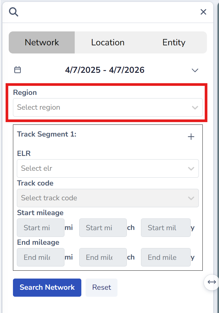
Select a Region (optional). Region is only available where Network Model (LRS) Groups have been configured.
-
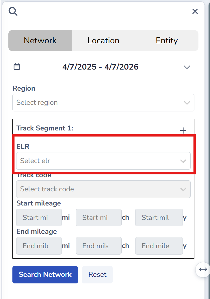
Enter the Route/ELR (mandatory) you wish to search for
-
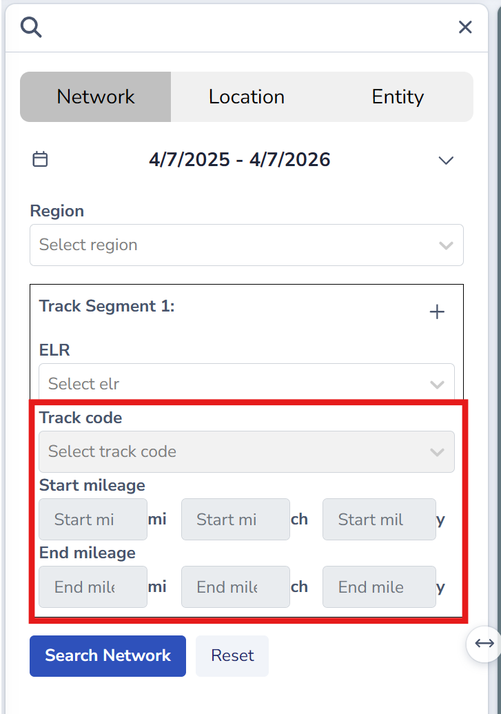
Select a Track Code and Start/End mileage (optional). The tracks available are dependent on the selected route
-
Click 'Search Network'
How to add a second route/track to a Network Search
-
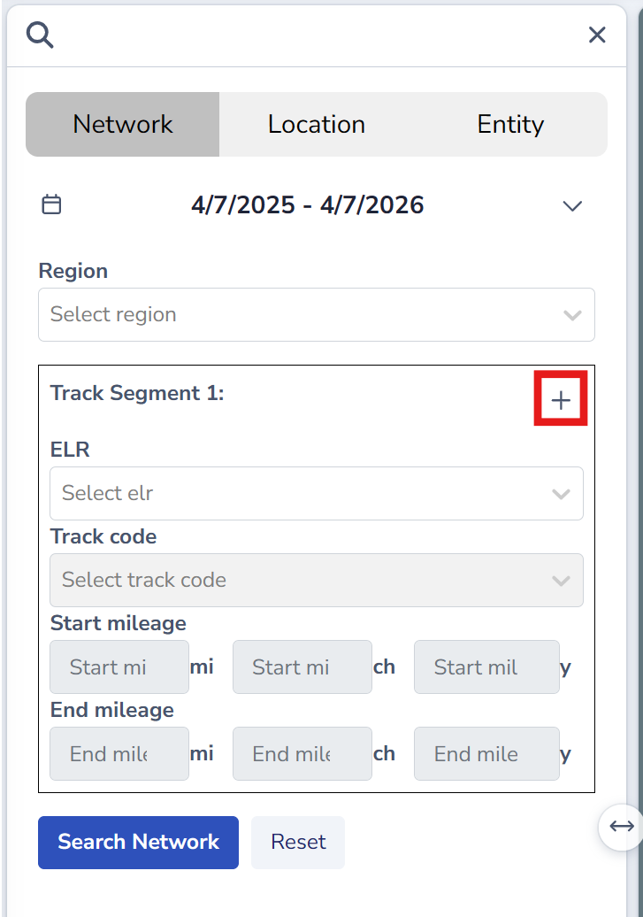
Click the ‘+' icon next to the 'Track Segment 1’ heading
-
Enter the Route/ELR (mandatory), Track Code (optional) and Start/End mileage (optional). The tracks available are dependent on the selected route
-
Click 'Search Network'
All data that pertains to any of the selected routes/tracks will be returned in the search results area.
Location Search
How to conduct a Location Search using latitude/longitude co-ordinates
-
Click the ‘Location’ tab in the search area
-
Edit the date filters, if applicable
-
Enter latitude and longitude coordinates
-
Adjust the size of the Search Radius, if applicable
-
Click ‘Submit’
Did you know?
The latitude and longitude fields are linked to the map. Clicking on the map automatically updates the co-ordinates; and updating the co-ordinates automatically re-centres the Search Radius on the Explorer map.
How to conduct a Location Search using the Search Radius
-
Click the ‘Location’ tab in the search area
-
Edit the date filters, if applicable
-
Click and drag the Search Radius (represented with a pink circle) on the Explorer map to place it over the area you wish to search
-
Adjust the size of the Search Radius, if applicable
-
Click ‘Submit’
How to resize the Search Radius
The search radius size can be set numerically using the ‘Radius’ field, or the slider can be adjusted manually. The Search Radius has a maximum of 100km/62mi.
How to reset a Location Search
Once a search has been submitted, the location will “lock” to that position. To begin a new search, use the ‘Reset’ button
How to show/hide the Search Radius
Users can choose to show or hide the pink search radius circle with the ‘Show Search Area’ checkbox, located in the top left of Explorer.
Note: the search radius automatically toggles off 5 seconds after a user submits a location search. It can be toggled back on using the ‘Show Search Radius’ checkbox.
Entity (Structure) Search
How to conduct an entity search using the Search Radius
-
Click the ‘Entity’ tab in the search area
-
Edit the date filters, if applicable
-
Select the Entity Type you wish to search for using the drop down (mandatory)
-
Enter the TSID or Entity Name you wish to search for (mandatory)
-
Adjust the size of the Search Radius, if applicable
-
Click ‘Submit’
How to filter and sort search results
To filter search results, click the filter icon
To sort search results, click the sort icon
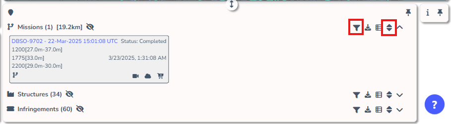
The filtering options and sorting options available are relevant to the entity type selected.
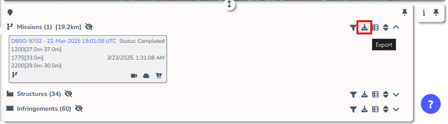
How to export search results
Users are able to export Explorer search results as either a .CSV (Comma Separated Values) file or a .GPKG (GeoPackage) file using the download icon in the header of the entity type.