

Overview
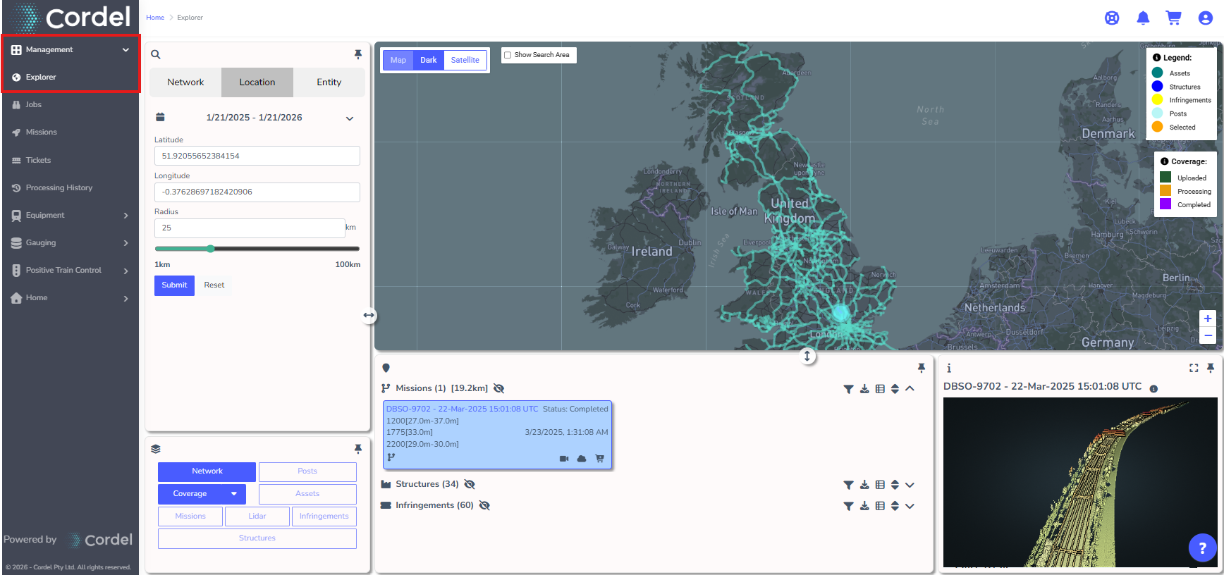
The Explorer page (commonly referred to as "Explorer" or "the Map") is usually the landing page for users when they first login to the platform. Explorer is the area of the platform where rail networks identify, inspect and interrogate inspection data at a network-wide level.
All captured data is centralised and displayed here, and BYOD ("Bring Your Own Data") can also be configured to show on the Explorer map.
To access Explorer, go to Management > Explorer from the main menu.
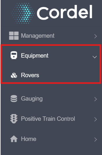
Where are my Rovers?
In Version 3.0.0 and above, all the Rover information including telemetry, history and current location is now located in Equipment.
Explorer Page Navigation
Legend
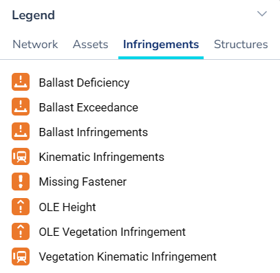
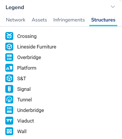
The legend displays the icons used on the Explorer map, with each entity type presented on a different tab. Select a tab to view the icon keys for that entity type.
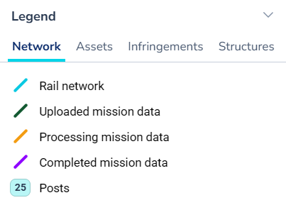
Network
The rail network and mission data overlaid on the map. Shows the physical track lines and the status of inspection missions captured along them (uploaded, processing, or completed). Posts mark kilometre or mile positions along the network.
Assets
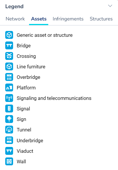
Fixed physical objects located along the rail corridor that are tracked for inspection and PTC compliance.
Asset icons are shown in blue.
Infringements
Detected conditions where a measurement or reading has exceeded a defined threshold or tolerance. Examples include ballast deficiencies, kinematic clearance breaches, missing fasteners, and vegetation encroachment.
Infringement icons are shown in orange.
Structures
Fixed civil or structural elements along the corridor that are monitored for structural condition. Overlaps with Assets in some types (bridges, tunnels, platforms) but is focused on structural integrity rather than asset tracking.
Similarly to assets, structure icons are shown in blue.
Map Display
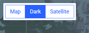
The map display options sit over the Explorer map in the top left hand corner. Users can switch between light, dark and satellite modes depending on their visual preferences.
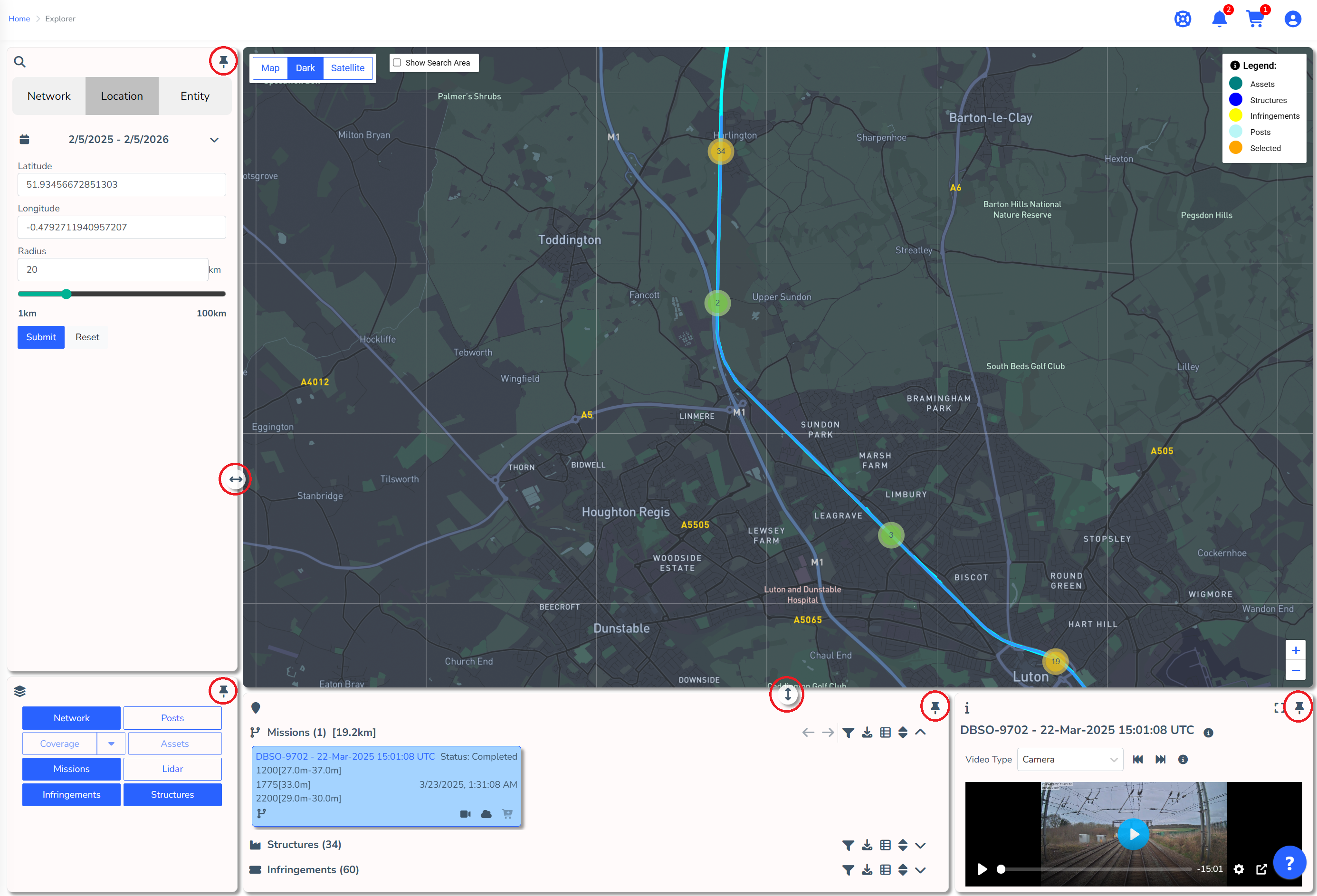
The Cordel Connect Explorer sections can be dynamically resized to suit user preferences using the resize icon.
Search
Users can search by Network, Location (latitude and longitude) or Entity.
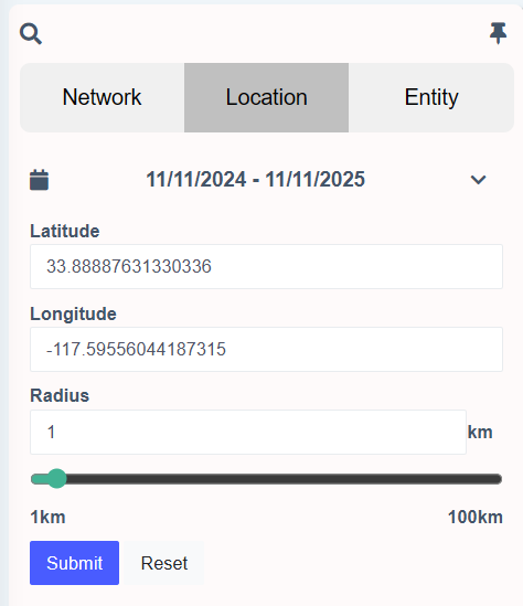
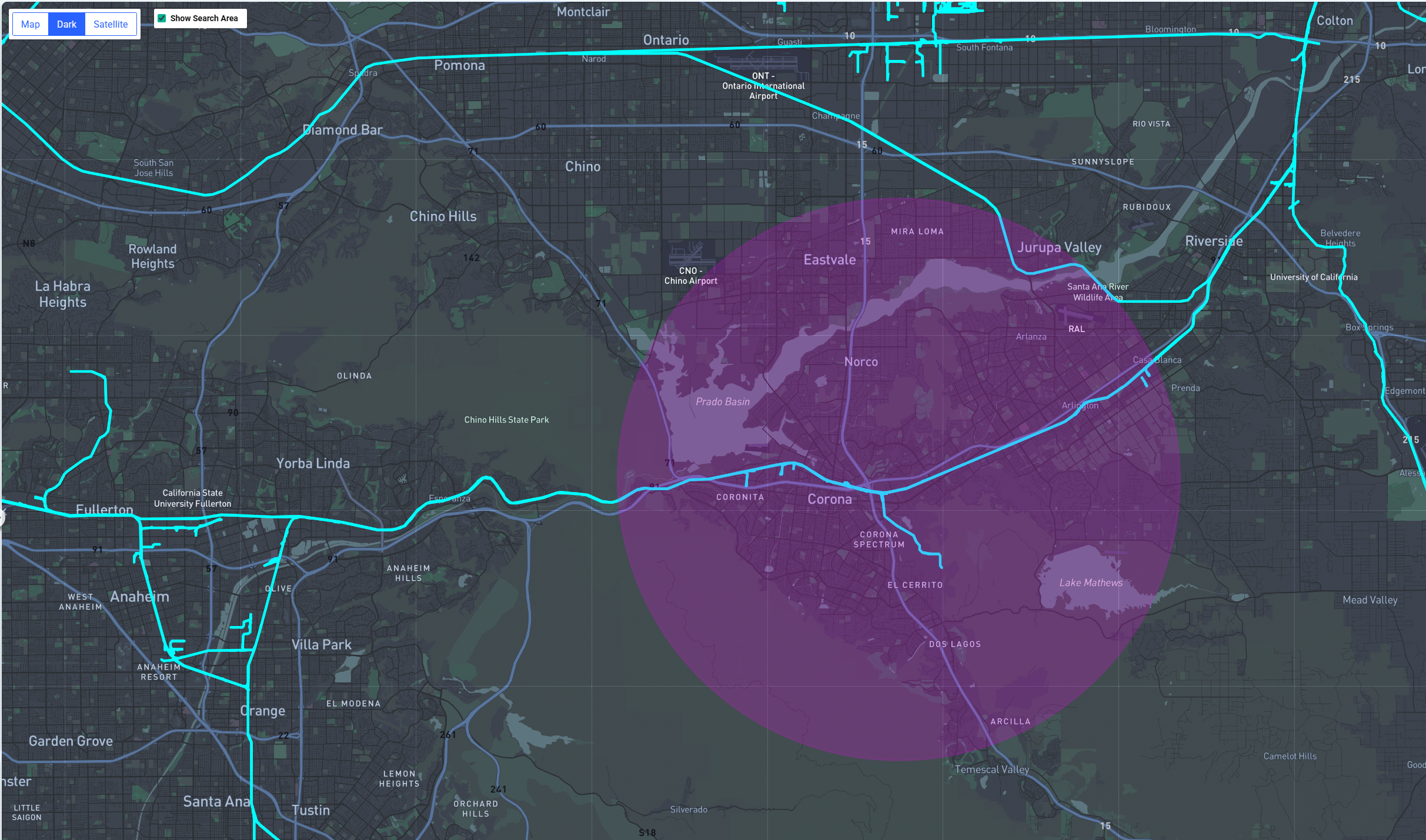
Users can also perform visual searches by clicking anywhere on the network path and adjusting the search radius (represented with a pink circle). Any data related to the selected area will be shown in the search results section at the bottom of the screen.
Learn more about how to Search in Explorer.
Layers
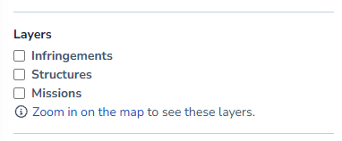
Layers represent data that can be displayed or hidden on the Explorer map. Layers are designed to be viewed at 'close-range' ie. when a user is zoomed in. The layers available will depend on the configuration of Cordel Connect.
Network Display
Network Display controls what is shown on the Explorer map at a network level, independent of individual entity layers.
-
Coverage — a colour-coded path showing the capture and processing status of all missions across the network, typically covering the last 12 months. Coverage can be filtered by month, mission status, and payload data type.
-
Posts — kilometre or mile posts displayed along the network, where provided with the Network Model. Used as geographic reference points.
-
GeoPackage layers — pre-built spatial layers uploaded to Reference Data, displayed as additional overlays on the map.
Learn more about Explorer Layers, Search Results and Preview.
Search Results
All data that meets the search criteria is presented as cards in the area below the Explorer map. This includes all missions, structures, assets and infringements of various types — dependent on configuration.
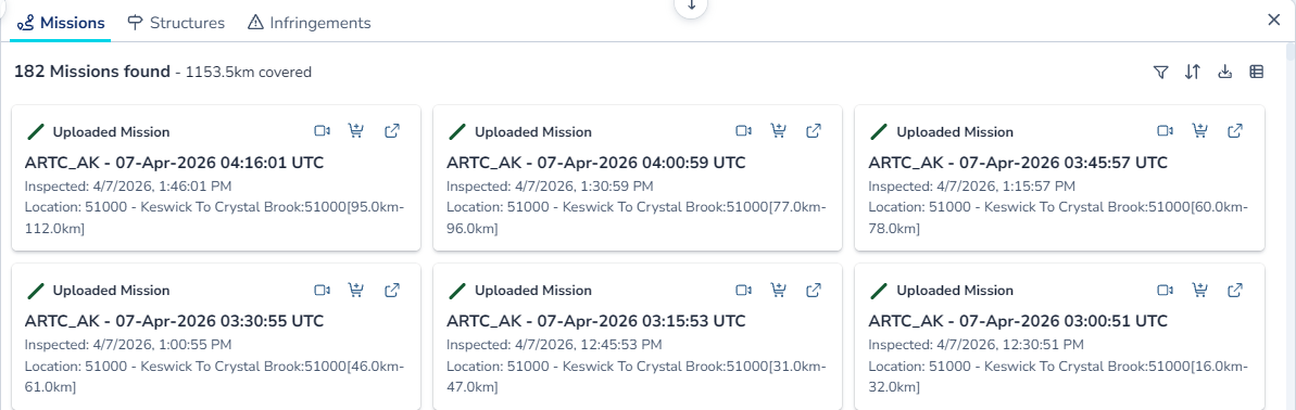
Users can add missions to the cart for further processing using the image-20250415-051408.png (add to cart) icon; or view associated information (such as LiDAR point clouds or video footage) using the relevant icons.

Preview Information
Visual information that corresponds to the selected search result card is displayed in this area. The visual information shown here depends on the type of search result selected, but commonly includes LiDAR Point Cloud, Video or Cross-Sections.
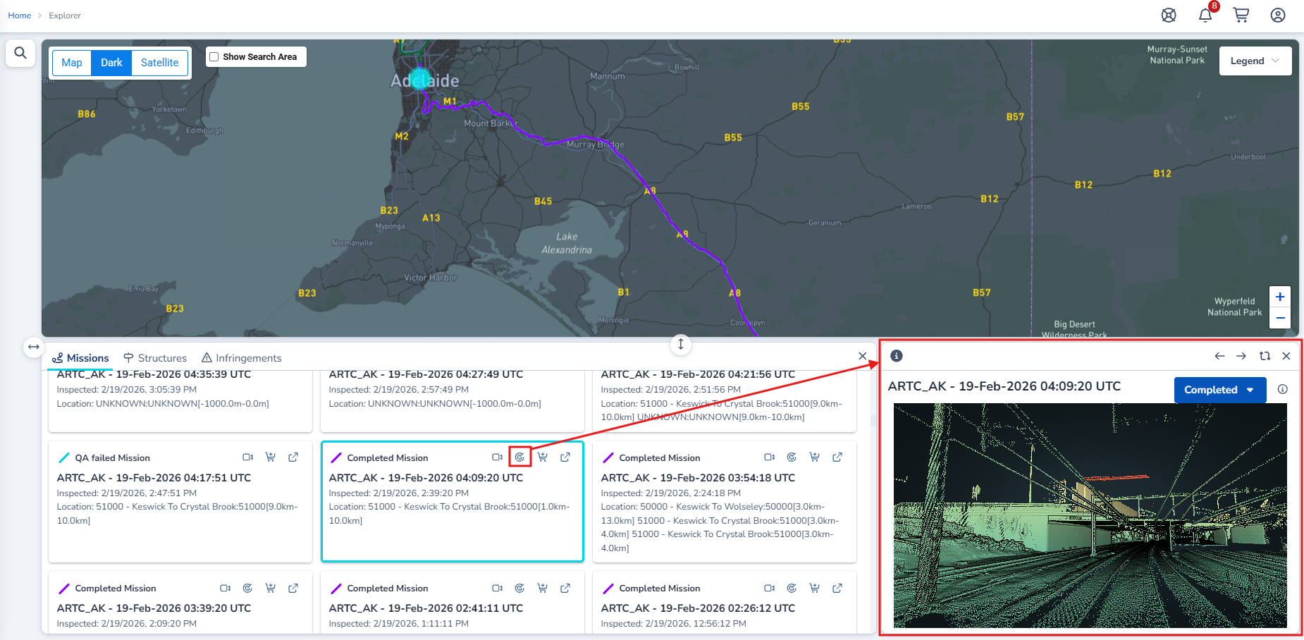
Learn more about Layers, Search Results and Preview Information.
Deep Link URL Parameters
Explorer supports deep linking — users can construct URLs that open Explorer with specific search criteria, filters, and view settings pre-applied. This is useful for sharing a specific view with colleagues or bookmarking commonly used searches.
Supported Parameters
|
Parameter |
Description |
Example Value |
|---|---|---|
|
|
Sets the entity type to search for |
|
|
|
Filters by entity status |
|
|
|
Filters results captured on or after this date (UTC) |
|
|
|
Filters results captured on or before this date (UTC) |
|
|
|
Sorts results by capture date |
|
|
|
Selects a specific search result card by numeric position |
|
|
|
Sets what is displayed in the hero/preview section |
|
Example
The following URL displays all completed missions captured between 1 January 2025 and 6 March 2026:
https://uat.aws.cordel.ai/Explorer?minDateUtc=2025-01-01&maxDateUtc=2026-03-06&entityTypeSearch=Mission&entityStatusSearch=Completed
The base URL will differ per organisation. Replace uat.aws.cordel.ai with your organisation's Cordel Connect URL.