

The Track Segment Viewer (the View Track Segment page) allows users to review detailed information about a Track Segment, view its history, review the Surveys associated with it, and view it on a map.
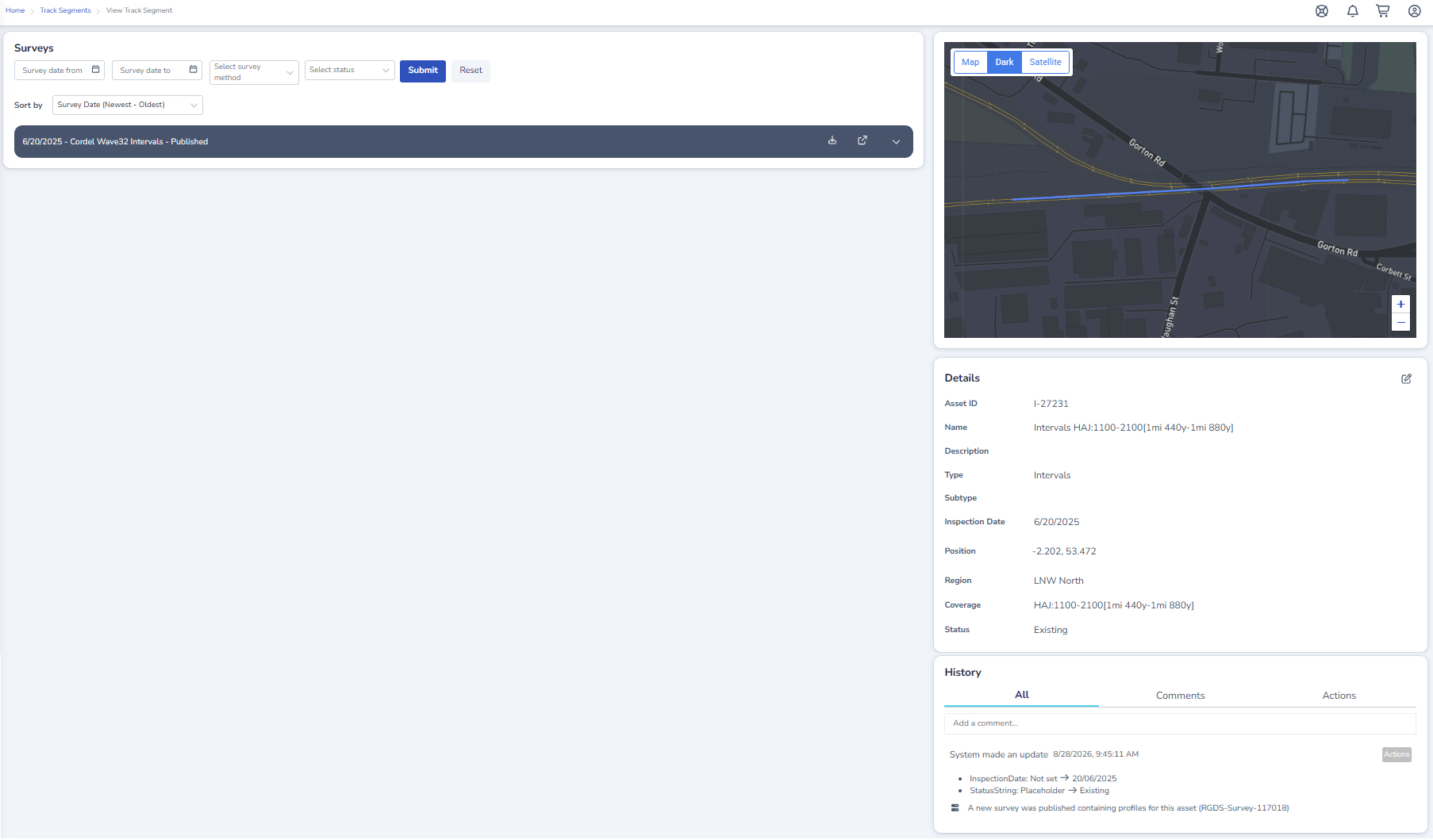
The Map
Users can view the selected Track Segment highlighted on a map, with Map, Dark, and Satellite view options.
Details
The Track Segment details/metadata including the ID, name and location.
Depending on user permissions, this information can be edited using the edit (pencil) icon. See How To Edit Track Segment Details.
History
System updates and user comments are displayed in the History card, giving users a detailed understanding of changes made to the Track Segment over time. The History card has All, Comments, and Actions tabs, and users can add a comment directly from this card.
Surveys
Users can view the Surveys associated with the selected Track Segment. The Survey list can be filtered by Survey date range, Survey method, and status, and sorted (for example, by Survey date). Each Survey can be downloaded, opened, or expanded for more detail.
How to view a Track Segment
-
Open the main menu in Cordel Connect and navigate to Gauging > Track Segments.
-
Search for the Track Segment(s) required using the search filters on the Track Segments index page.
-
Click the corresponding row to open the Track Segment in the Track Segment Viewer.