

What is a slice?
A slice is a two-dimensional, cross-sectional representation of the rail corridor at a specific location. Each slice shows the spatial relationship between the track and surrounding infrastructure.
Slices are used to understand clearances by visualising the position of real-world objects—such as structures, platforms, vegetation, or equipment—relative to the track. When grouped together, slices form surveys - the foundation for clearance assessment, compliance checking, and reporting.
Each slice is generated from survey data collected along the rail network. That data captures the position of:
-
The left and right rail heads
-
Objects and structures surrounding the track
-
The relative horizontal and vertical position of each point
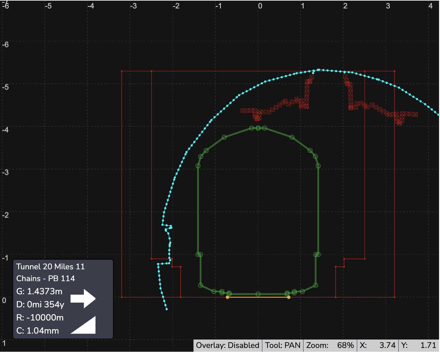
Measurement reference point
All measurements within a slice are taken from a consistent reference point to ensure accuracy and repeatability.
-
Distances are measured horizontally and vertically from the left (running) rail head
-
Objects are positioned relative to this reference to show their true clearance from the track
-
This approach ensures consistent comparison across slices, surveys, and reporting outputs.
Coordinate systems
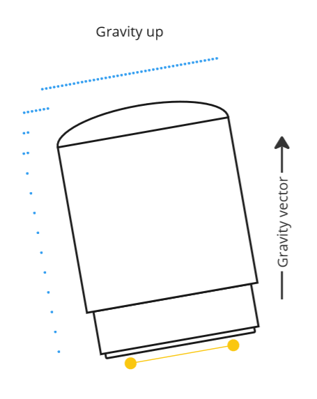
There are two major 2D coordinate systems used when describing gauging data relative to railheads: plane of rail and gravity up.
Cordel’s Gauging module employs a 'gravity up' coordinate system, which aligns the railheads in a way that gravity is always pointing directly vertically.
How to view a Slice in Slice viewer
Slice Viewer can be opened from several places in Cordel.
-
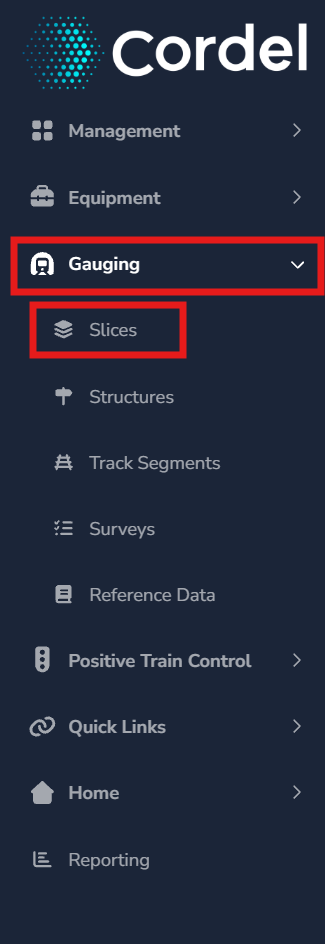
To open an exiting Slice, users need to first open the Slice Index page. Open the main menu in Cordel connect and navigate to Gauging> Slices.
Slices can also be accessed via the ‘Slice List’ shown on the following pages:
-
Survey Viewer: Navigate to Gauging > Surveys, search, and click a Survey's name to open it in Survey Viewer. The Survey Slice List, shown below the map, lists every slice in that survey — click a slice's name to open it.
-
Structure Viewer: Navigate to Gauging > Structures, search, and click a Structure's name to open it in Structure Viewer. The Survey Slice List, shown below the map, lists every slice in that survey — click a slice's name to open it.
-
Mission Viewer: Navigate to Management> Missions, search, and click a Mission’s name to open it in Mission Viewer. The Survey Slice List, shown below the map, lists every slice in that survey — click a slice's name to open it.
-
Survey QA warnings/failures On the Survey Viewer page, the Quality Assurance Summary logs any warnings, failures, or passes for that survey. Click a warning or failure to open the slice that triggered it.
-
Map view On the Structure or Survey Viewer map, click a slice marker, then click View in the popup to open it.
Once a slice is open in Slice Viewer, you can move between related slices by:
-
Use the next/previous arrow keys, or
-
Select a slice from the Sibling Slices tab.
🔗 Slice Viewer
More detailed information on interacting with Slices.
How to create a Slice
Slices are generated as part of the Survey creation process. To understand how Slices are created, go to How To Create A Survey
How to edit a Slice
Slices are edited using the “Edit Survey” process. To understand how Slices are edit, go to How To Edit Survey Slices