

This release allows users to access more detailed historical hardware data and delivers significant improvements to structure assignment functionality (dependent on configuration).
Core Product Updates
⭐ Feature Highlight: Rovers Page Overhaul ⭐
Cordel connect
-
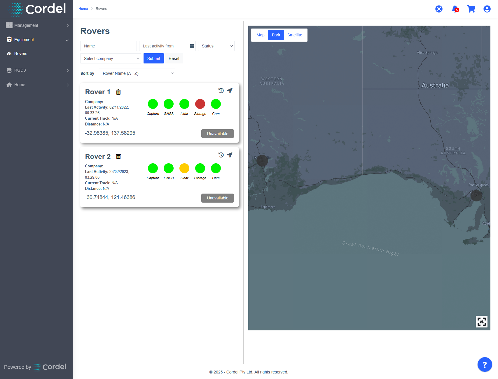
Rovers are no longer visible on the Explorer map, and the 'Rovers' page has been updated to include a map view and search filters.
-
Infringements displayed on the mission map are now more flexible, and more infringement types can be displayed, the layer controls have also been updated reflect this change
-
The LiDAR viewer 'Scene' section in the sidebar has been rearranged, to sort and group the nodes by capture section name
vegetation
-
If a vegetation report has been generated, but no vegetation was found in the data, a message will be displayed noting this, rather than an empty graph
Feature Updates
Features may or may not be available to you depending on the configuration of your Cordel Connect account. Please contact your account manager for more information.
clearance/gauging
Some of the features in this section will not be available in certain environments.
-
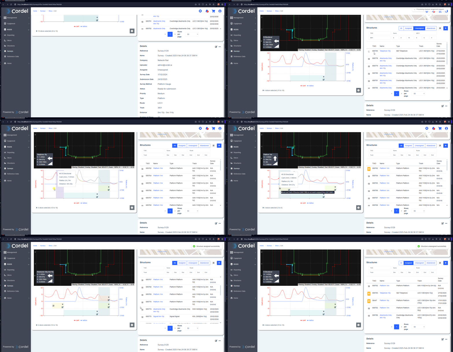
When users attempt to assign a group of slices in a survey to a structure record that does not match the slices track information they now see a warning
-
Users are given the option to create a new placeholder structure on the correct track
-
A new 'broken link' icon will be displayed at the left-hand side of the structure section in the navigator graph if the slices do not match the assigned structure's track
-
-
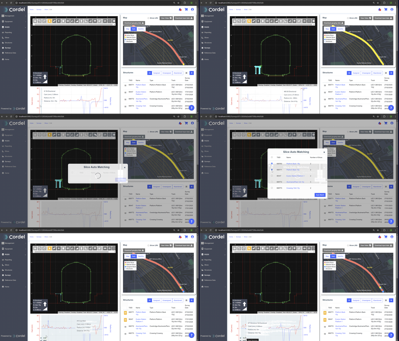
Users can perform the auto structure assignment action on the selected slices within a survey
-
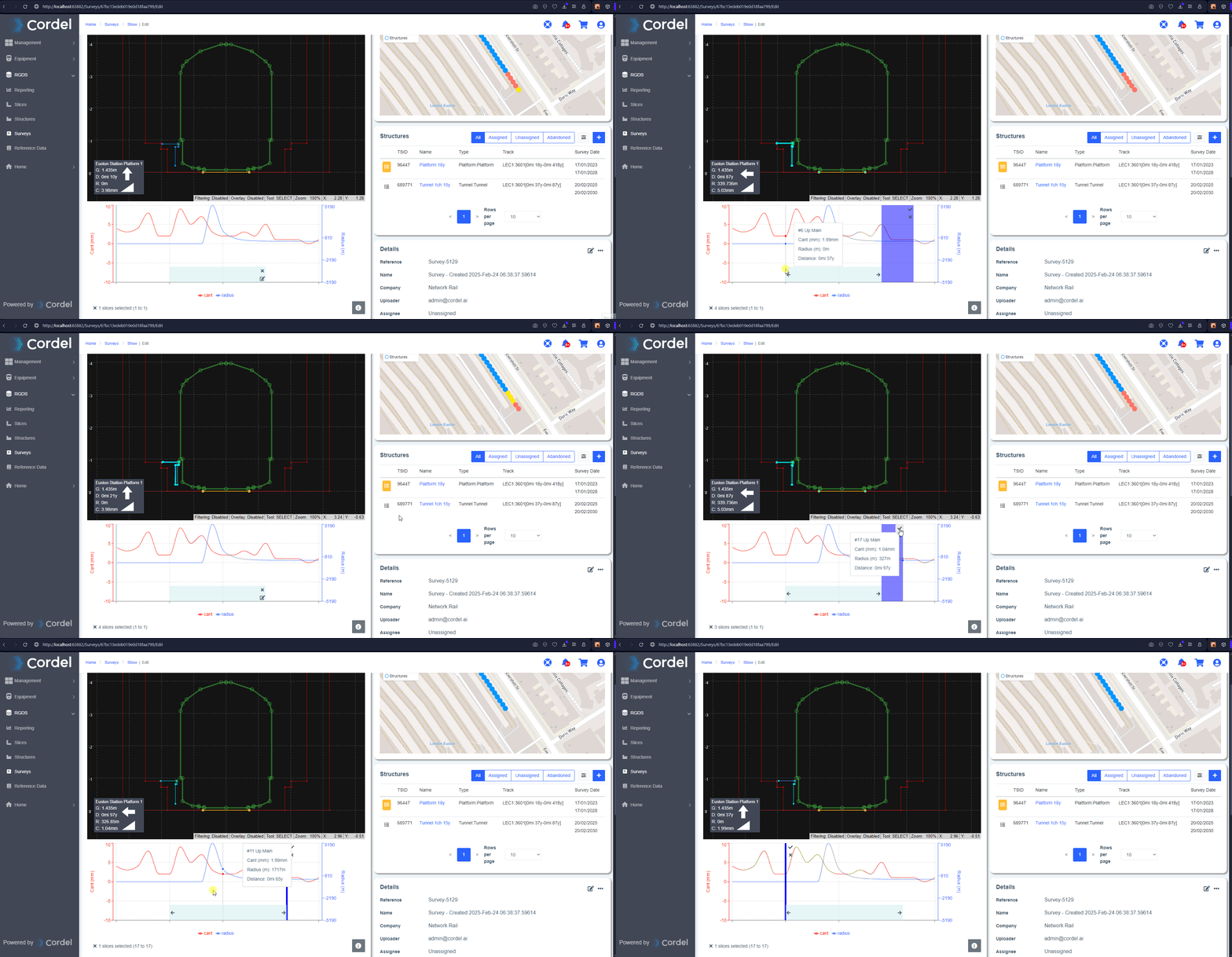
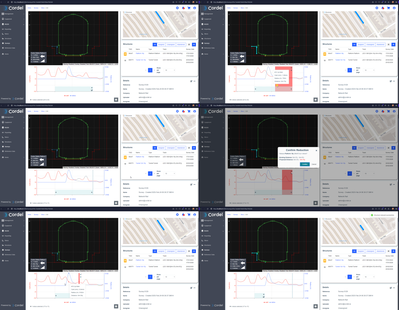
Users are now able to add and remove slices from an assigned structure through the navigator graph
-
This feature will enable users more control over which slices are associated to a structure, without having to fully unassign and reassign the data
-
The existing hotkeys for slice selection can be used when in extend or reduce mode
-
-
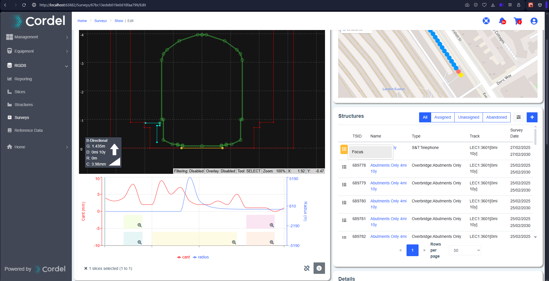
The structure options popup menus can now be accessed when a survey is in a final state in the system (e.g. Published, Withdrawn) and includes an option to focus the navigator on the chosen structure
-
On upload, the system will reject that a survey contains slices on a single unique track and provides an option to split the survey into groups on unique track (generating multiple surveys)
-
The auto structure assignment process has been improved and now considers the linear information of slices alongside their geospatial position
-
If the new duplicate feature is enabled, the system will create a placeholder structure if the geo position of a slice matches, but the linear information does not
-
-
A new URL pattern has been provided to navigate to a structure using it's TSID
🐞 Fixes 🐞
Cordel Connect
-
Fixes an issue when displaying a popup menu on a scrollable section of the site
-
Fixes an issue that caused a large y-axis offset between slice data points and quality assurance images