

This release brings key functionality from the Mission Page onto the Explorer page, allowing users to access critical information without 'clicking through' to the Mission Viewer. It also includes improvements to the History Card functionality and implements improvements to the report visualisations on the Mission Viewer page. Back-end improvements and bug fixes have also been included, continue to improve the overall customer experience.
Core Product Updates
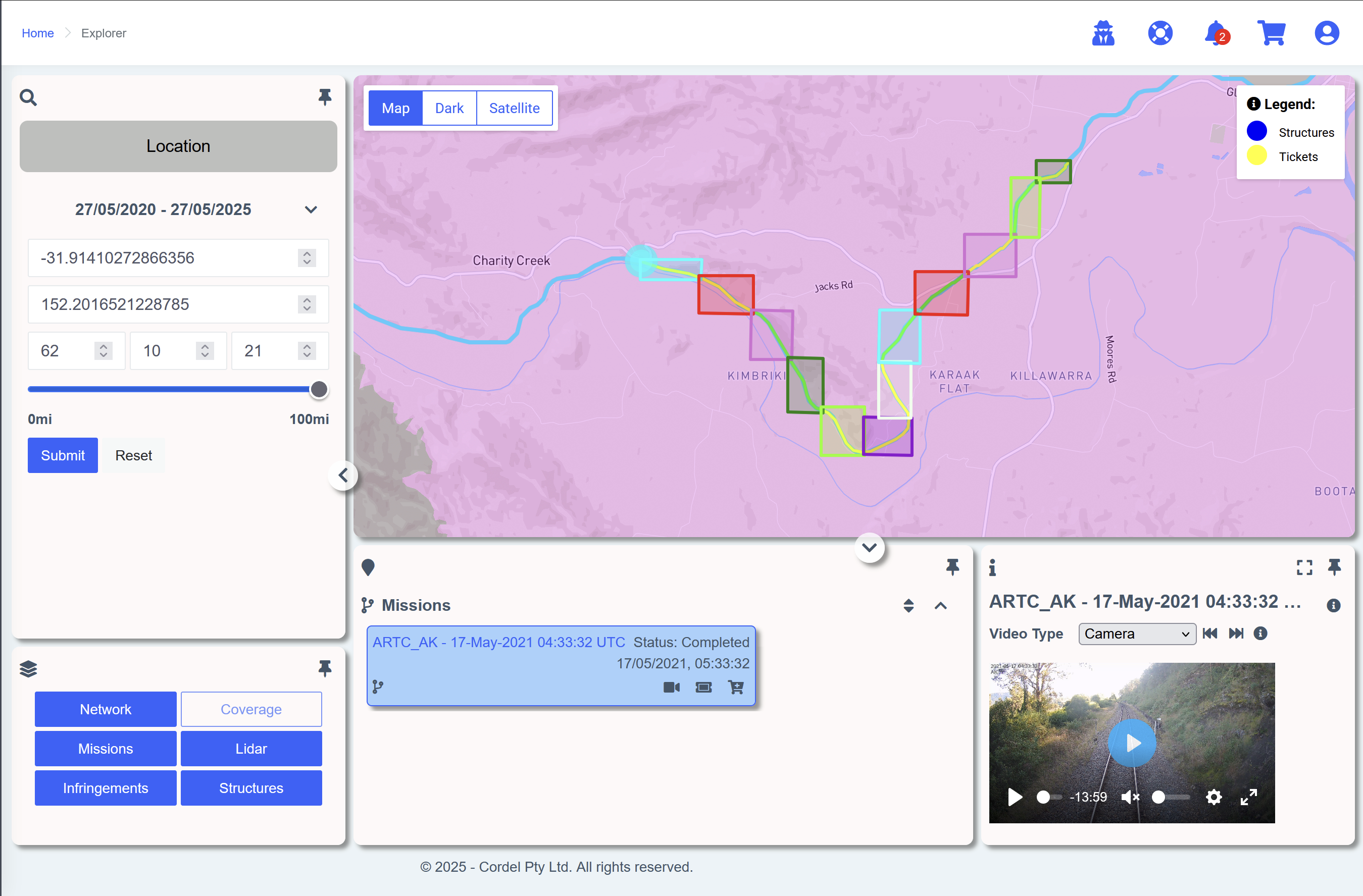
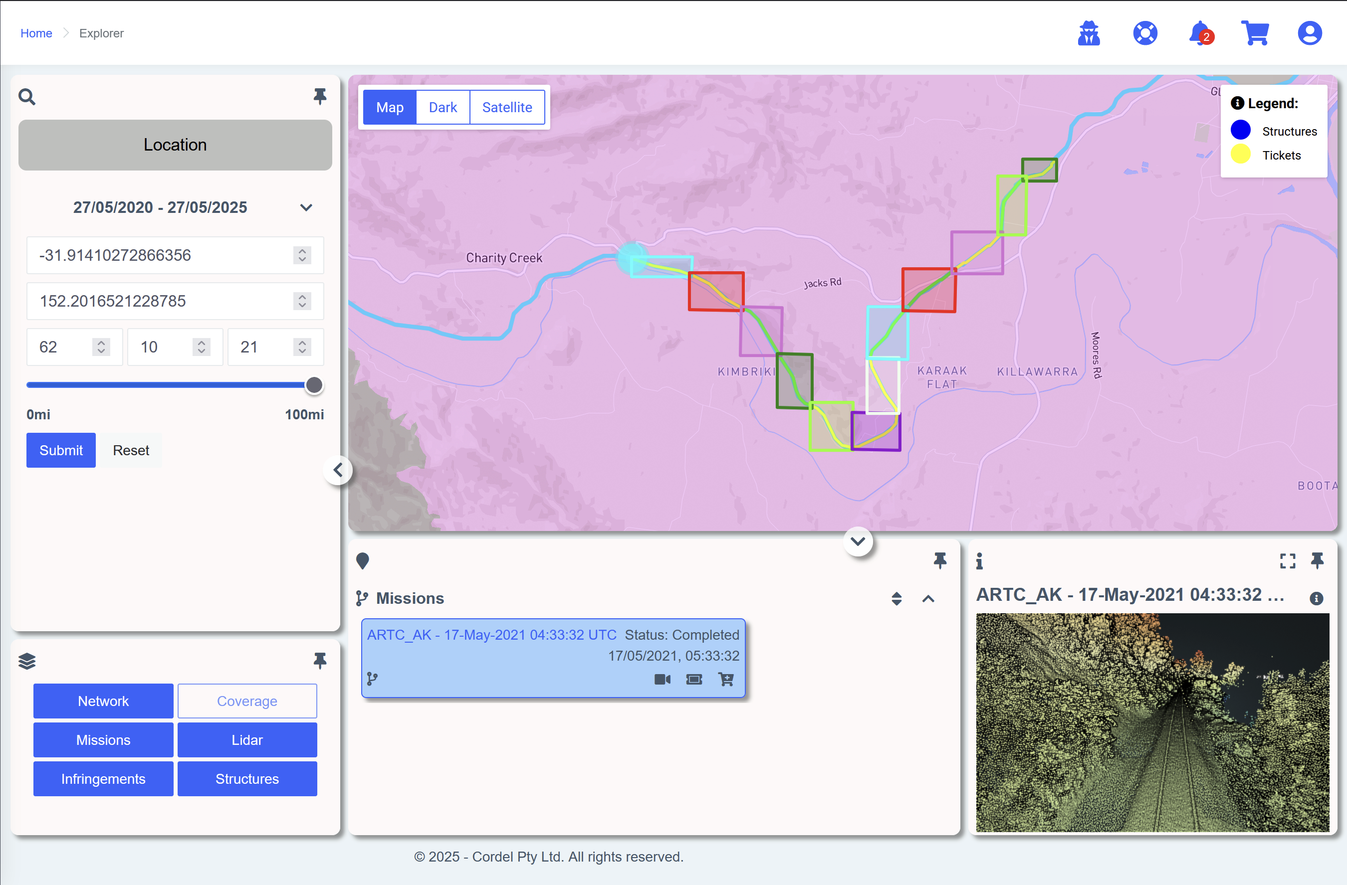
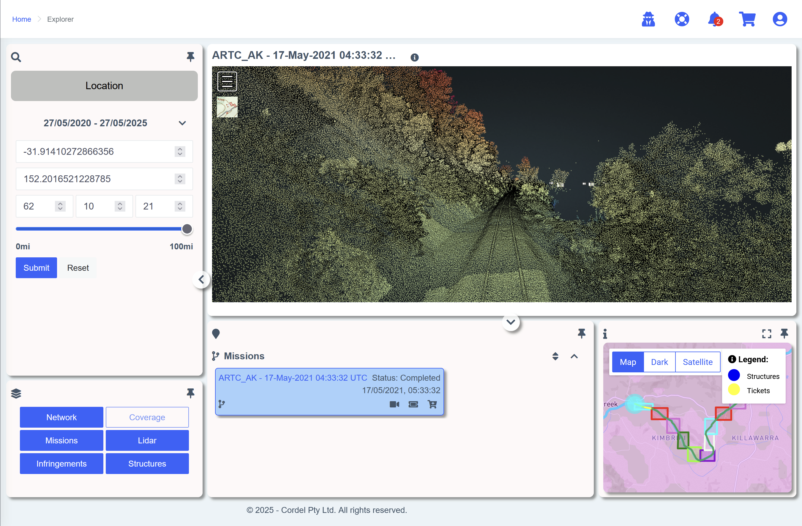
⭐ Mission Features Now In Explorer ⭐
Cordel connect
When a mission is selected - either by clicking on a mission card in the search results area, or by clicking on a mission path on the Explorer map, users now have the ability to:
-
View mission videos continuously where an adjacent capture section is detected
-
View the mission trajectory and Rover map marker
-
See the LiDAR bounding boxes
-
Watch the corresponding video on the Explorer page
-
View and interact with the LiDAR point cloud using the LiDAR Viewer on the Explorer page
-
Highlight the map, video or LiDAR using the 'hero' section function
Mission Report Visualisation and Configuration
-
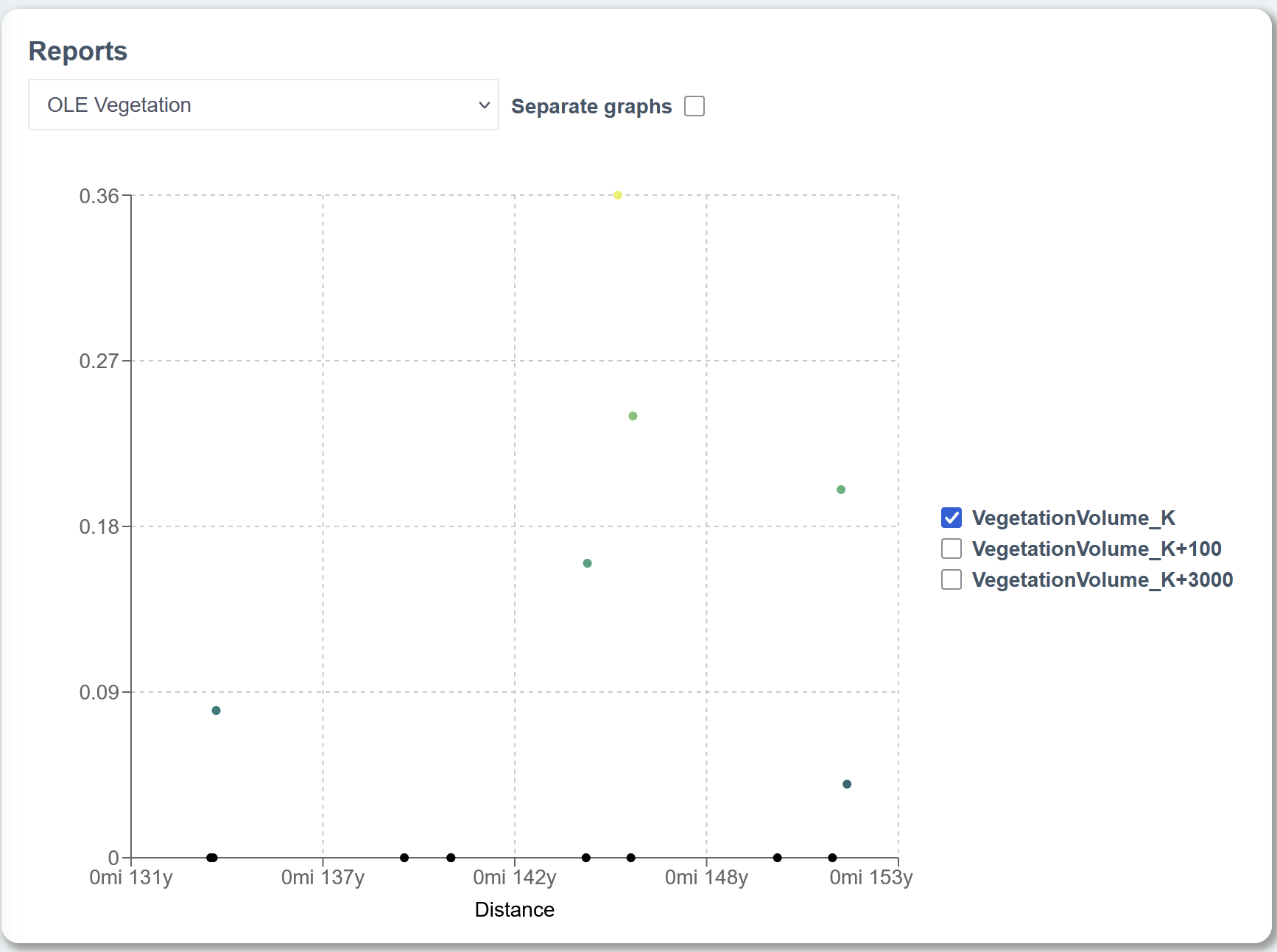
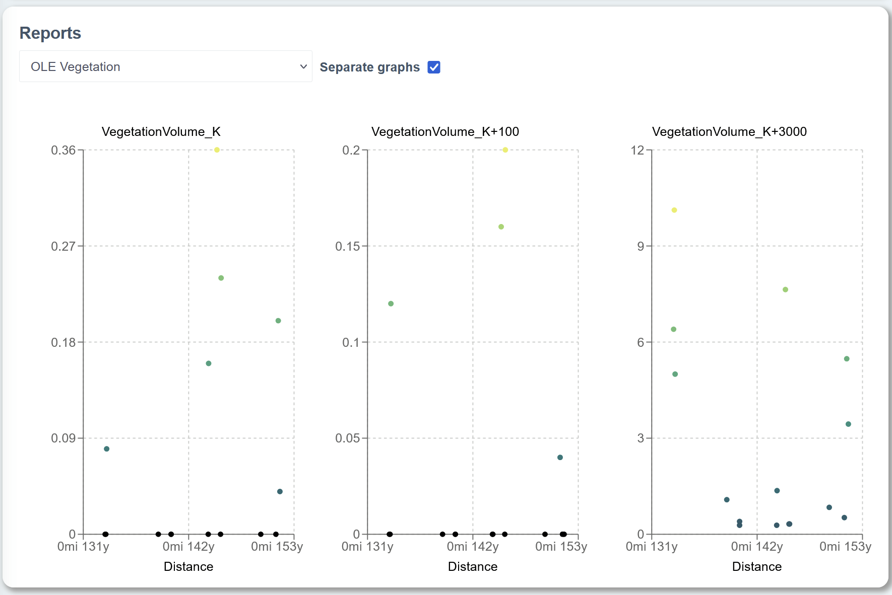
More reports can now be visualised on the Mission Viewer page (pending environment configuration)
-
If a report includes multiple data points, they can be displayed on the same graph, or separated into separate graphs
-
Cordel Connect reports are configurable, and allow a business to define the data that is presented in each report.
History Card: category tab
-
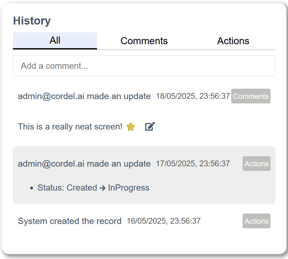
Entries in the History pane are now categorised according to their content
-
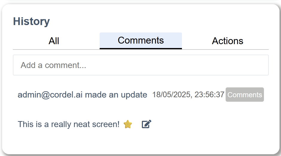
Entries that are strictly comments / notes are categorised as 'Comments'
-
Entries that are changes to the data are categorised as 'Actions'
-
Note: changes with a comment are still considered 'Actions'
-
-
Users can choose to view all categories, or view only comments or only actions
-
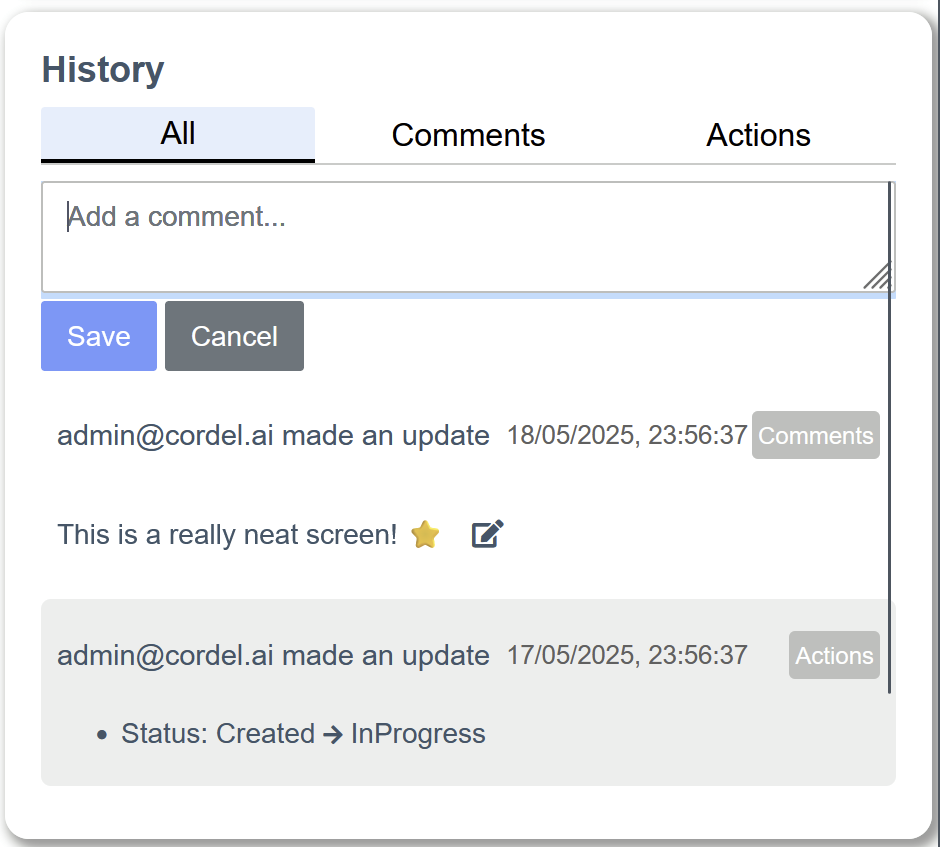
The comment input is now available on screen at all times. Simply click the 'Add a comment…' input bar, type your comment and hit save.
Minor Improvements
-
The 'Coverage' layer on the Explorer page will now provide an indication of the status of different missions in an area using colour, and a new legend has been added to the map when the layer is enabled
-
There have been some improvements made to the way that processed outputs for a mission are surfaced, ensuring that only data that has been thoroughly reviewed and marked for delivery can be viewed and interacted with
Fixes
-
Fixes an issue that hid Structure markers on the Survey map
-
Fixes an issue that caused Slice quality assurance images to be offset from points in the viewer
-
Fixes an issue that caused Job details to fail to save when updated
-
Fixes an issue with pagination when changing page size in some circumstances
-
Fixes an issue that caused Ticket images to break when interacting with the Explorer map in some circumstances
-
Fixes an issue that caused complex queries as part of login redirect to be lost