

This release introduces enhancements to the Explorer module, including improved coverage controls, support for pre-built GeoPackage layers, and the ability to search by group name in the Network search tab. The team have also made performance improvements to the Slice editor and a number of bug fixes.
Core Updates
CORDEL CONNECT
Explorer
Updated user interface
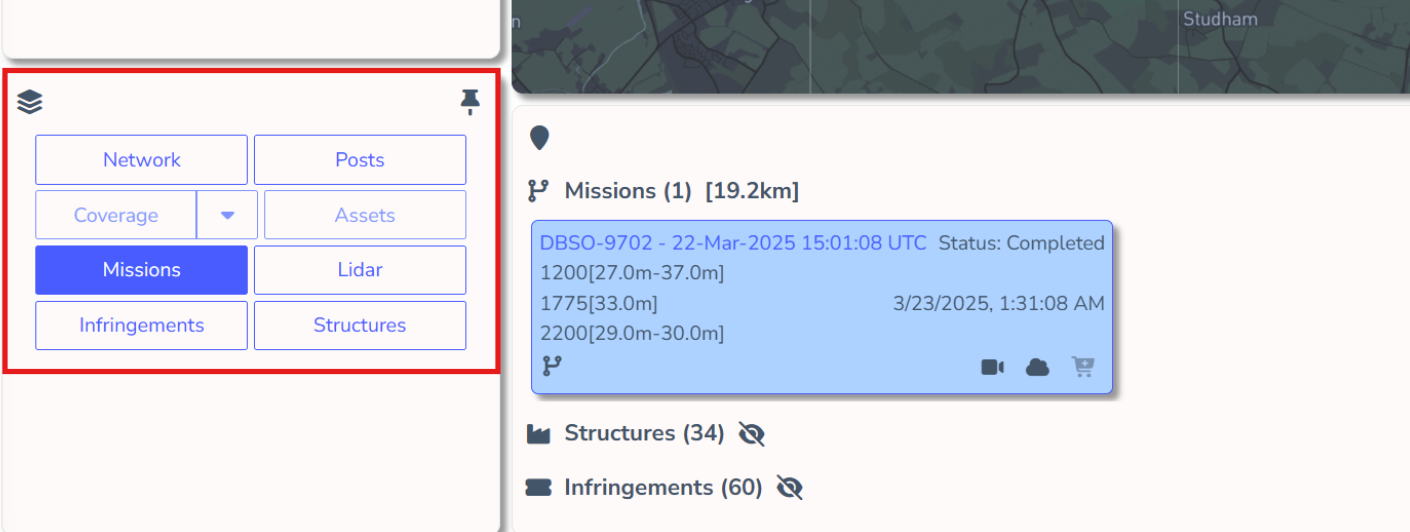
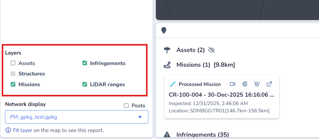
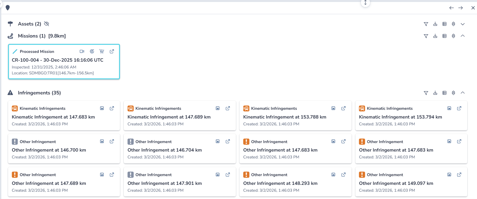
Significant improvements have been made to the user interface, with a particular focus on layer management.
|
|
|
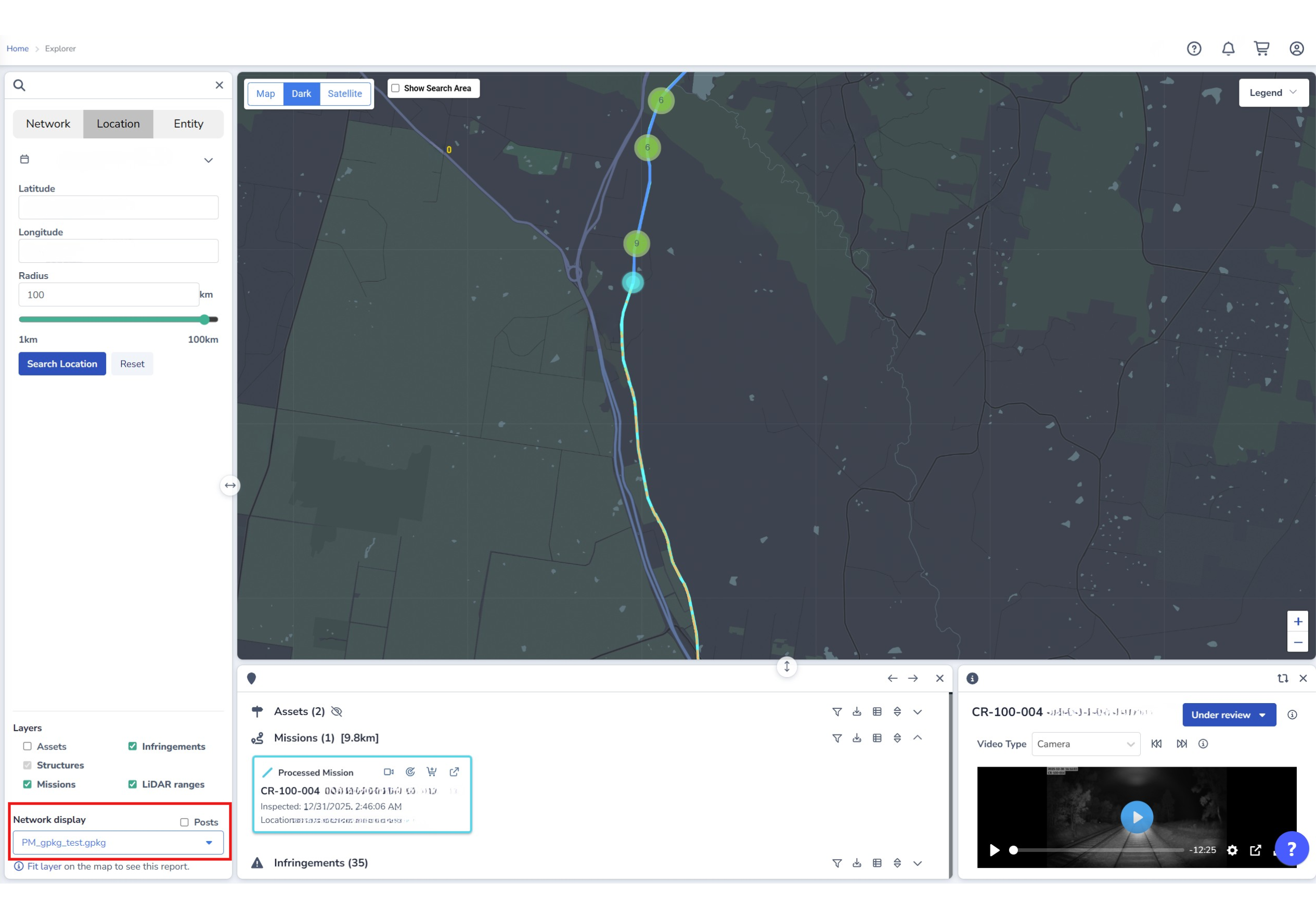
Upload and view pre-built layers
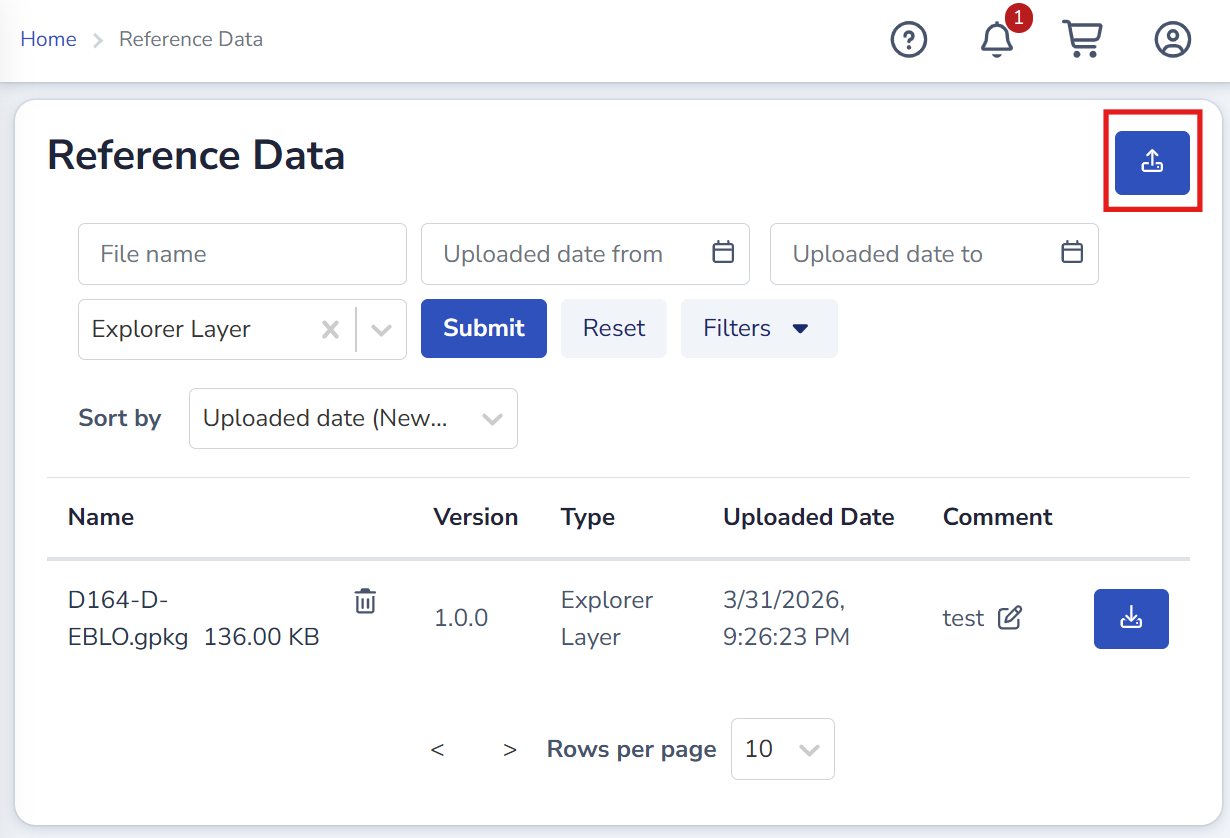
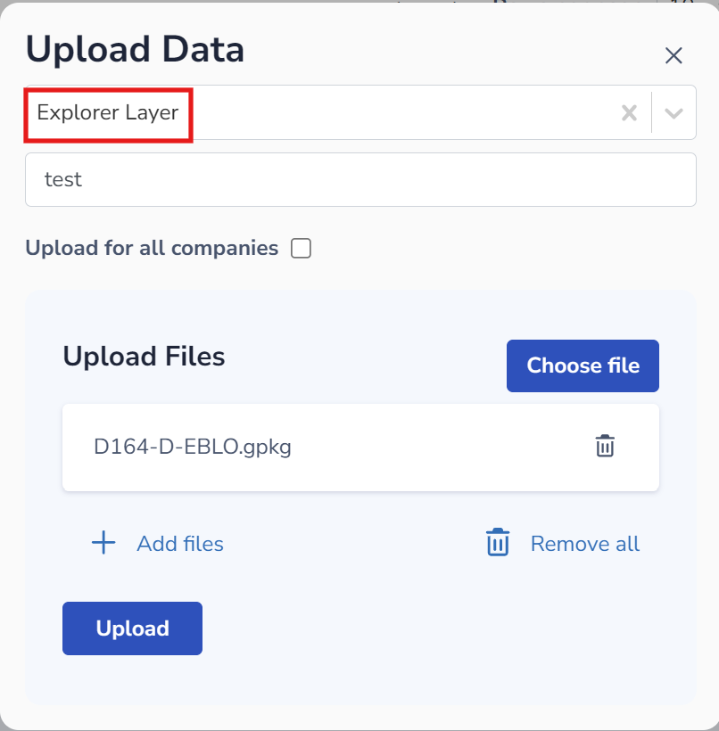
Users can upload GeoPackage (GPKG) files via the Reference Data page and then display the information on the Explorer page using the layer functionality.
|
|
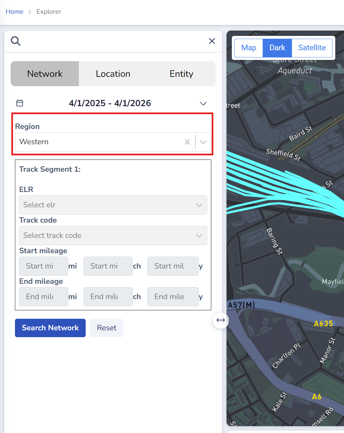
Search by 'Region' in Network search
Users are able to search by Region on the Explorer network tab. Region information is also displayed on Mission result cards.
This functionality relies on predefined Network Model (LRS) Groups being configured.
Coverage enhancements
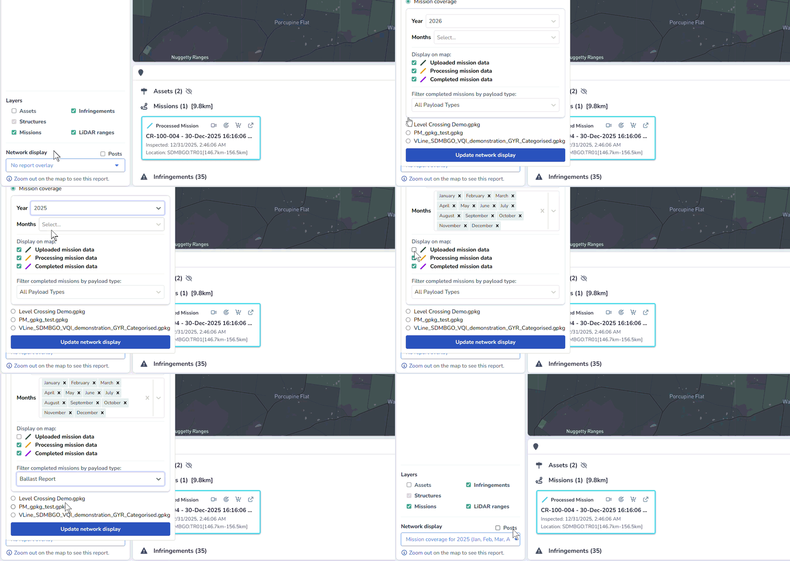
Users can now apply more granular controls to coverage data in the Explorer:
-
Coverage data can be filtered by one or more months within the same year.
-
Coverage paths can be filtered by mission status.
-
When 'Completed mission data' is toggled on, completed mission paths can be filtered by payload data type (only completed missions have payload data).
Minor Improvements
CORDEL CONNECT
Missions
-
Data Group information is now included in CSV and GeoPackage (GPKG) exports where groups are configured.
GAUGING / CLEARANCES
Surveys
-
Performance improvements: Slice Editor and Slice Viewer have been improved to better handle larger selections.
Reporting
-
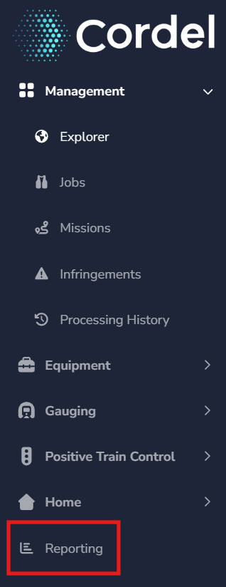
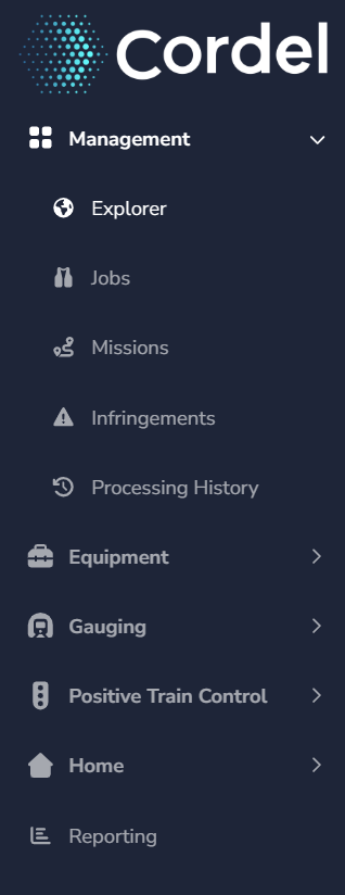
Main menu update: The Reporting menu item has been moved to the top-level navigation, outside of the Gauging / RGDS menu.
GENERAL
User Interface
-
UI updates: user interface style updates have been applied across the platform, including changes to fonts, icons, colours, and shadowing.
|
|
Carts
-
Cart approvals: users with permission to submit a cart are now notified when a request is raised by a user who does not have that permission, allowing them to approve or deny the request.
Fixes
CORDEL CONNECT
-
Fixes an issue where a mission page would crash when accessed from a Survey with an invalid timestamp position argument.
-
Fixes an issue where the Nearby Missions list would include the current mission.
-
Fixes an issue where the sidebar menu did not always reflect the page being viewed.
GAUGING / CLEARANCES
-
Fixes an issue where creating a new Structure on the Survey Edit page would navigate to the newly created Structure instead of assigning it to the selected slices.
EQUIPMENT
-
Fixes an issue on the Rovers page where the rover status was not displaying the worst-case status when multiple warnings or errors were reported.
PTC
-
Fixes an issue where the LiDAR viewer camera position when viewing a Detection on an Audit may return undesirable results.