

Overview
This release of Cordel Connect introduces Track Intervals — a comprehensive gauging capability for multi-track environments that measures the spatial relationship between rolling stock on adjacent tracks. This release also delivers the ability to export Rover history as GeoPackage files, Capture Status filtering for Rover telemetry, Explorer usability improvements, and platform-wide bug fixes.
Core Updates
GAUGING/CLEARANCES
Track Intervals
Cordel Connect now includes a comprehensive Track Intervals module for multi-track surveying. The Track Intervals Gauging module measures the spatial relationship between rolling stock on adjacent tracks — providing chart-based analysis of interval data across a full survey run, including left rail, centreline, and right rail measurements for each track.
Track Intervals is available to clients where the feature has been enabled. Contact your Cordel account manager to discuss access.
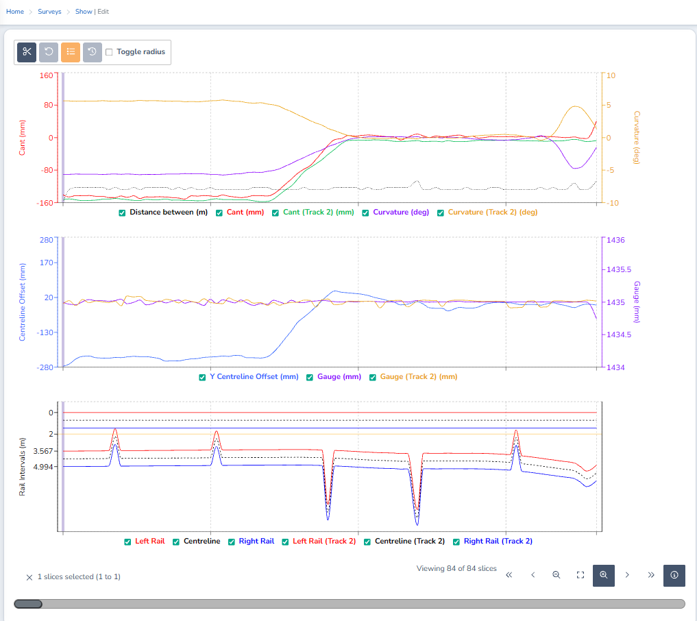
Track Intervals geometry graph
New Features
EQUIPMENT
Rovers
Export telemetry as a GeoPackage file
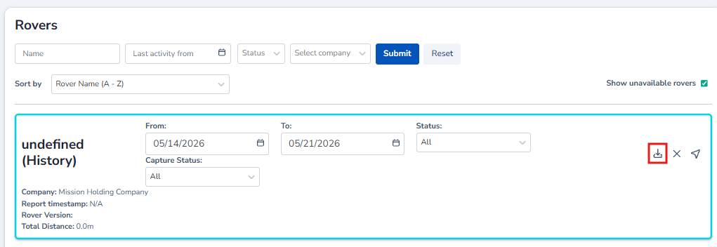
Export Rover telemetry data as a GeoPackage (GPKG) file
Filter telemetry history by Capture Status filter
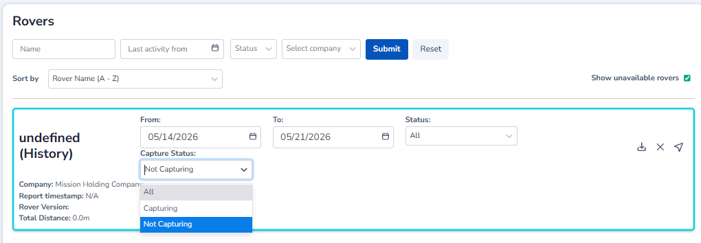
Filter Rover telemetry data by capture status
Minor Improvements
CORDEL CONNECT
Explorer
Sort and Filter by linear position
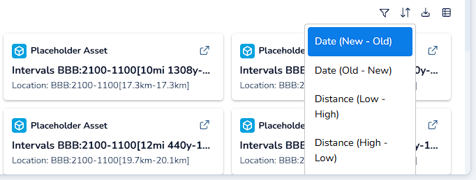
Sort by Distance
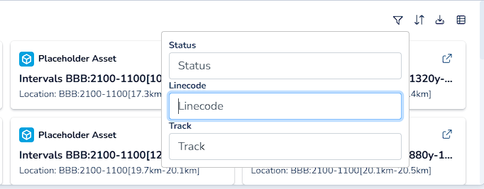
Filter by linear position
Content Scaling
Content scaling on the Explorer page has been improved. Images no longer overflow their containers or require the user to scroll.
Mission Video Deep Link Scrubbing
Explorer deep links for Mission videos that include a geospatial position now scrub the video to the corresponding location automatically.
Structure Autocomplete — ID and Name Display
Structure autocomplete fields now display both the asset ID and name (ID: Name) when showing candidate results, making it easier to identify the correct structure when multiple records share a similar name.
Mission Trajectory — Metric Removal
The Average separation and Fix rate metrics have been removed from the mission trajectory pop-up window.
Ticket Viewer
Ticket History
A history log has been added to the Ticket details page.
Admin
Admin Notifications — Access Requests
All administrator-level users now receive a notification when an access request is created in the system.
gauging/clearances
Surveys
Survey Map — Mission Trajectory Display
The survey map can display the trajectory from the source mission, provided the mission was generated by Cordel and exists in the current environment.
PTC
Audit Page
Minor UI improvements have been made to the Audit page in the Positive Train Control module.
Imperial Projection Units
The point cloud comparison view now supports imperial projection units.
Fixes
CORDEL CONNECT
Explorer
-
Fixed an issue where the Network Model option became unavailable, preventing users from hiding the Network Model layer.
-
Fixed an issue where the LiDAR ranges layer was hidden in all cases.
-
Fixed an issue where swapping between panels caused the map, video, and point cloud views to reset.
-
Fixed an issue where CSV exports output unexpected values in date and time columns.
Navigator
-
Fixed an issue where structures disappeared from the navigator in some circumstances while zooming.
Forms
-
Fixed an issue where distance validations were applied incorrectly in rare circumstances (for example, when creating a structure).
EQUIPMENT
Rovers
-
Fixed an issue where the Rover page map repeatedly panned and zoomed when changing search filters or as new data was received.
-
Fixed an issue that silenced Rover error notifications.
PTC
Audits
-
Fixed an issue with camera position calculation when viewing point clouds in a PTC audit.
-
Fixed an issue where the point cloud comparison remained stuck on the same view when selecting a new detection.