

Core Updates
CORDEL CONNECT
Explorer
User Interface improvements to map layers, coverage reports, and search results.
-
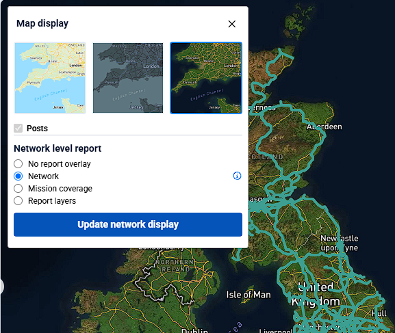
Map layers and coverage reports are now managed in a new ‘Map display’ panel within the Explorer map. Map types are updated when selected and reports are updated once the “Update network display” button is clicked
-
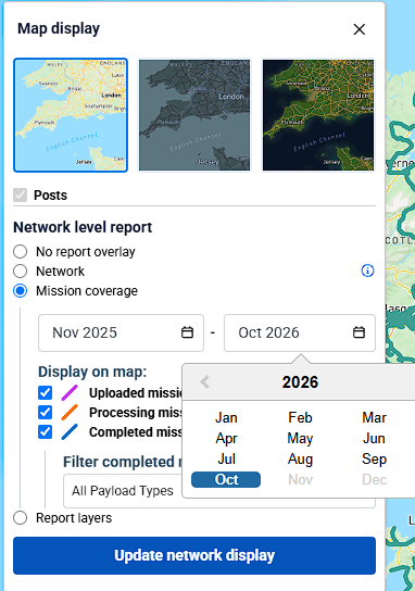
The mission coverage report layer date selection has been revised, allowing a user to select data across calendar years rather than restricted to a single year. Note the overall range is still limited to a single year.
-
Search results are no longer capped at 1000 entries, and instead, allow the user to navigate through pages of all of the entries
Minor Improvements
Management
-
The Processing History page now lists number of missions rather than number of jobs
Equipment
-
The total distance displayed while viewing Rover history will now update to match the filtered paths on the map
Gauging Data
-
The ‘Download gauging data' operation is now restricted to published data
-
Note: a new permission has been added to allow a user to download gauging data that is not yet published
-
-
The Survey search page now has a single multi-select field to filter by company
Fixes
-
Fixed an issue that caused a single slice point to be selected during region selection when releasing the mouse button while a point is being hovered
-
Fixed an issue that caused slices to remain on their previous position on the map after updating their track
-
Fixed an issue that caused the network search to return missions that were not an exact match to the provided filters