

Core Product Updates
⭐ Infringements are now available in the LiDAR Viewer ⭐
Cordel connect
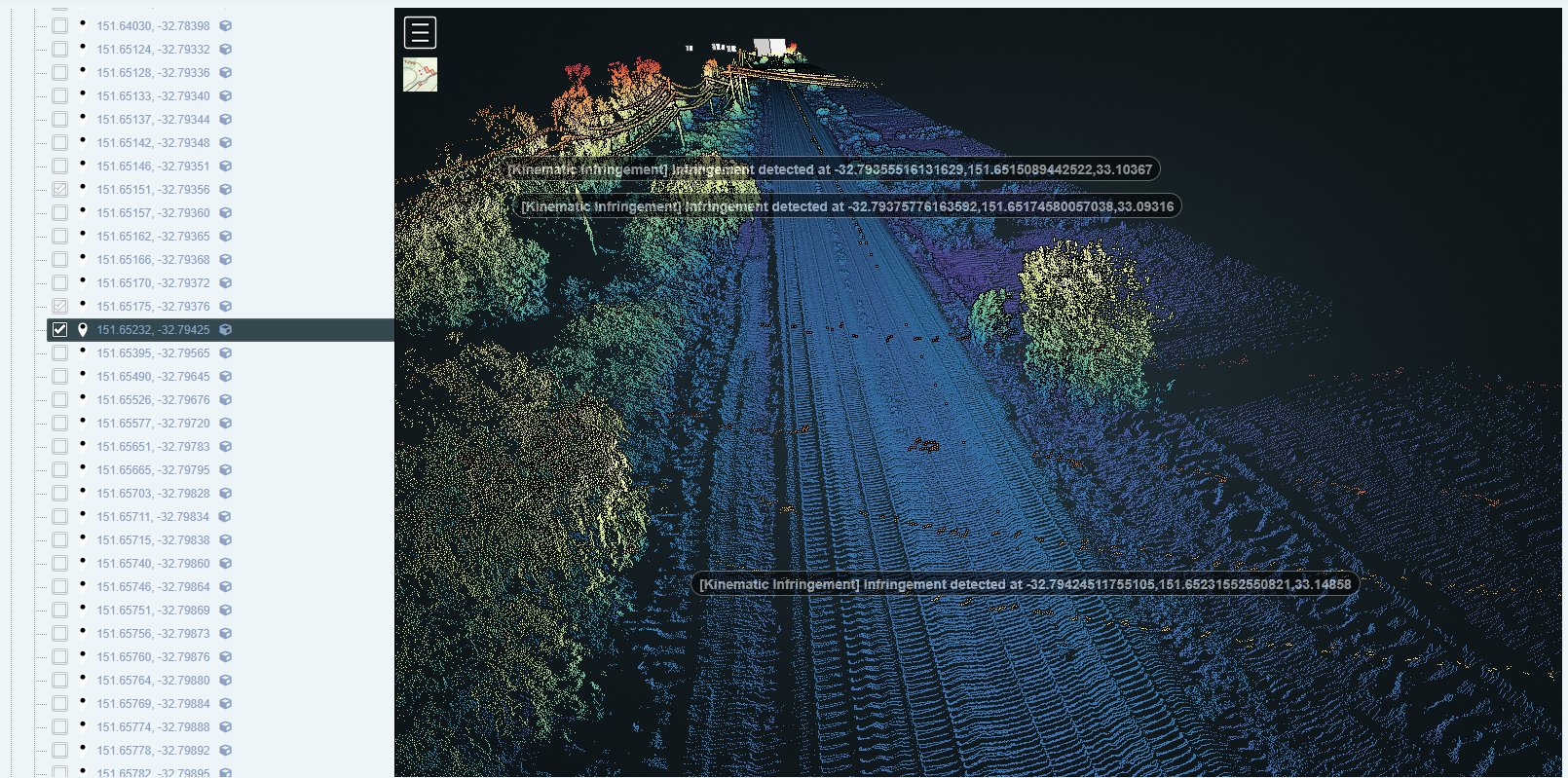
Infringement tickets are now automatically available when a user loads a mission in the LiDAR Viewer.
Tickets are plotted geospatially in the point cloud and can be toggled on/off using the check boxes in the sidebar:
Infringement tickets are grouped together on the sidebar based on infringement type:
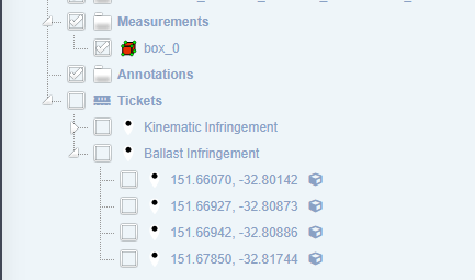
Infringement categories can be toggled on and off as a group, or tickets can be toggled on and off individually.
The image-20250827-042255.png 'cube' icon shown against each infringement can be used to clip a section of track in the LiDAR Viewer, showing one or more of the infringements and the scene around them.

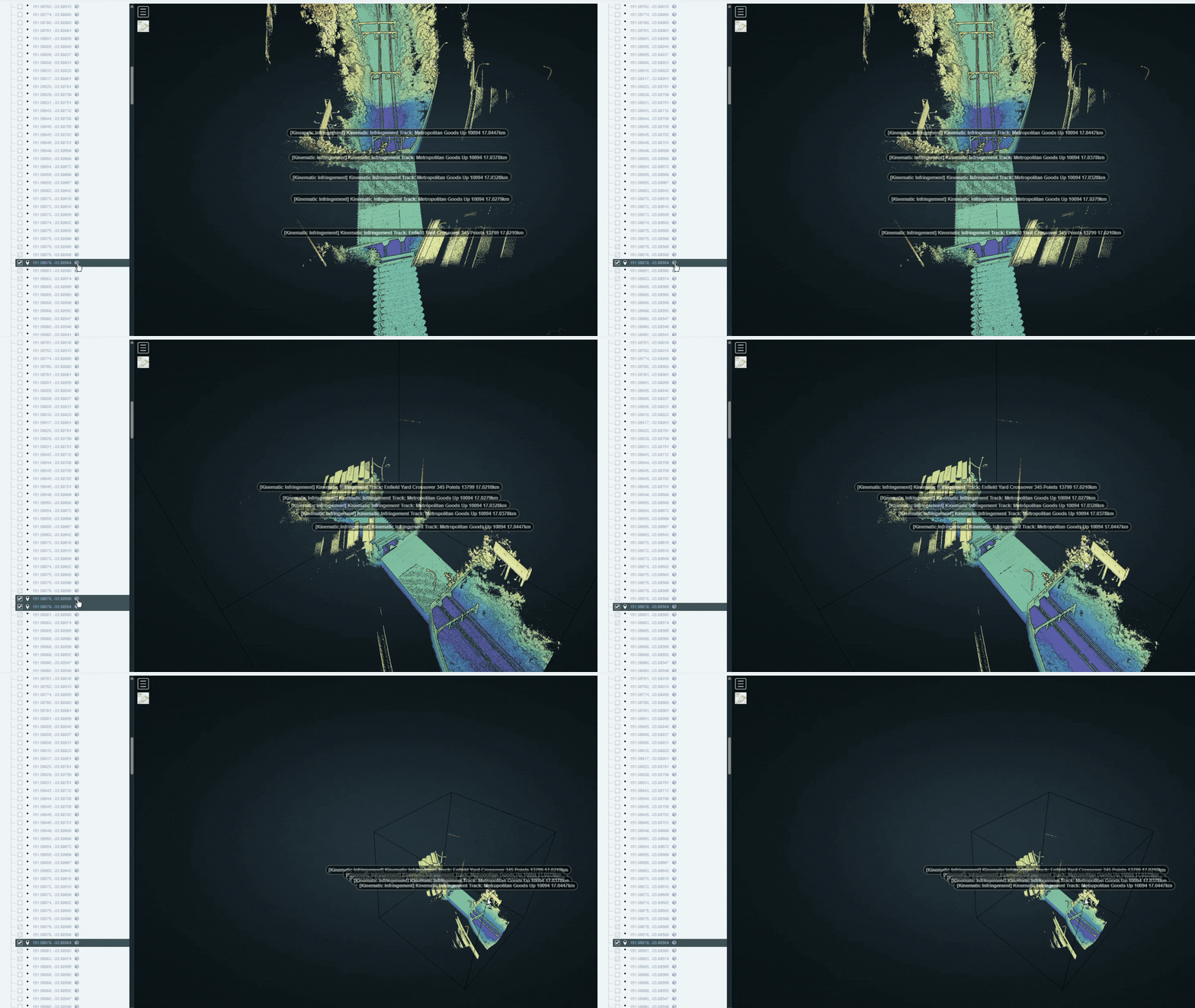
The red X in the Clipping section of the sidebar will clear the selected clip/s and return to the full point cloud view.

Double clicking an Infringement ticket in the sidebar list will relocate the user to that location in the point cloud:
⭐ Other Platform Enhancements ⭐
cordel connect
Infringement Ticket Status Functionality
Infringement Tickets are now assigned to a status and can be transitioned to different statuses by a user. Tickets can also be filtered by status on the 'Ticket Search' page.
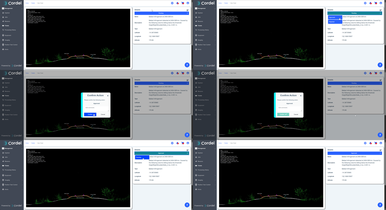
By default, all infringement tickets will show as 'Pending'.
If enabled, users will have the option to transition from 'Pending' to another status (for example, 'Approved' or 'Rejected') on the details card on the ticket viewer page. This functionality is flexible by design, allowing statuses to be configured in a way that reflects client workflows.
New QA Check - to ensure at least one slice is associated with a structure
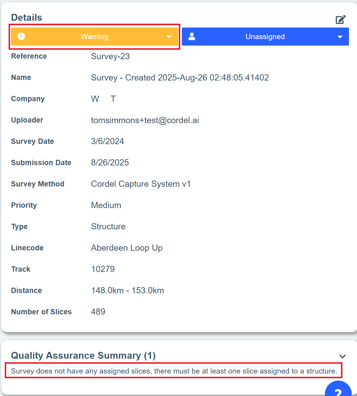
There is now an option to enable a Survey Quality Assurance Check, which ensures a structure has been assigned to one or more slices. When enabled, this check runs when the Survey is Submitted for Review, in conjunction with the existing QA checks.
If there are 0 slices assigned to a structure this will trigger a QA warning, and this information will be displayed on the existing Quality Assurance Summary card:
Structure Search
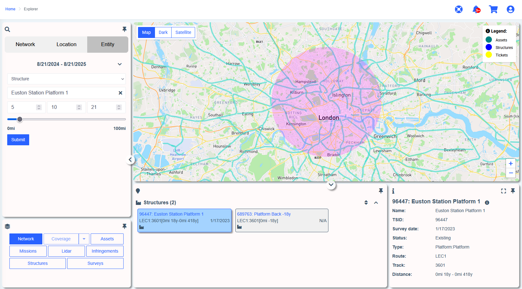
Users can now search for specific entities (platforms, structures, etc) within a specified radius on the Explorer. This will return all entities that exist within the radius specified:
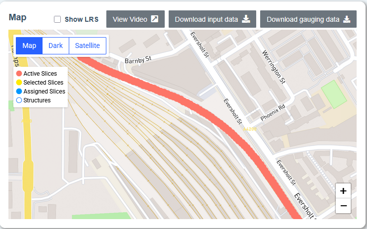
Zoom buttons have been added to Cordel Connect Maps
This feature improves useability across device types, especially for users who are zooming in/out using a laptop trackpad.
Minor Improvements
The Structure Type and Subtype are now displayed in alphabetical order
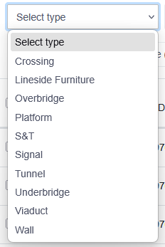
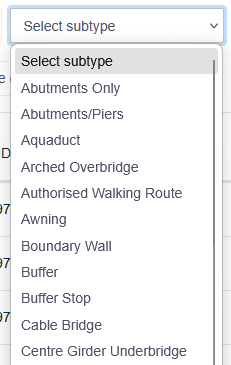
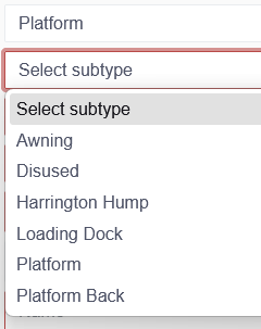
Comments and System Notes are now editable/read-only
Comments are presented with a image-20250826-051216.png 'speech bubble' icon, and can be edited, whereas system notes have a image-20250826-051239.png 'server rack' icon, and are read-only.


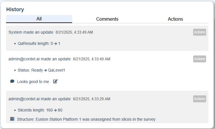
An action may have a list of changes, comments or system notes - or any combination of all three. Comments added without any action being performed are categorised as comments.
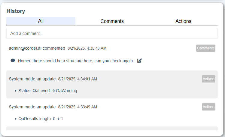
Comments can still be added to actions, and can be edited.
Mission Report Graphing Tool: Units of Measure
Mission Reports are now displayed using the company specified units of measure, rather than the raw measurements contained in the CSV files. These report graphs will now reflect Metric, Imperial (Miles & Yards), Imperial (Miles & Feet) or Imperial (Decimal) - depending on the company configuration.
Fixes
-
Fixes an issue when editing the survey details which caused the Assignee to be reset/unassigned when a user clicked 'save'.
-
Fixes an issue where slices that were automatically assigned to structures during import/creation were not duplicating the original slice data.
-
Fixes an issue on the Explorer page which was causing images in the details panel to be deformed as they did not maintain their aspect ratio.
-
Fixes a performance issue when using the Processing History page with a large number of carts.
-
LiDAR Viewer fixes
-
Fixes an issue which intermittently resulted in the "Profile Files" group being unavailable in the sidebar (not displayed).
-
Fixes an issue which intermittently resulted in the Kinematic Profile .PLY file being unavailable in the sidebar (not displayed).
-
-
Mission Viewer fixes
-
Fixes an issue where the 'camera' video type was not being selected by default.
-
Fixes an intermittent issue with files not being displayed properly in the payload data section.
-
Fixes an issue where map layers were not able to be turned on and off as expected.
-